
Southeast end: N2 near Coega | ||
 | ||
Northwest end: B3 at the Namibian border at Nakop Major cities Cradock, Eastern Cape, Upington, De Aar, Northern Cape | ||
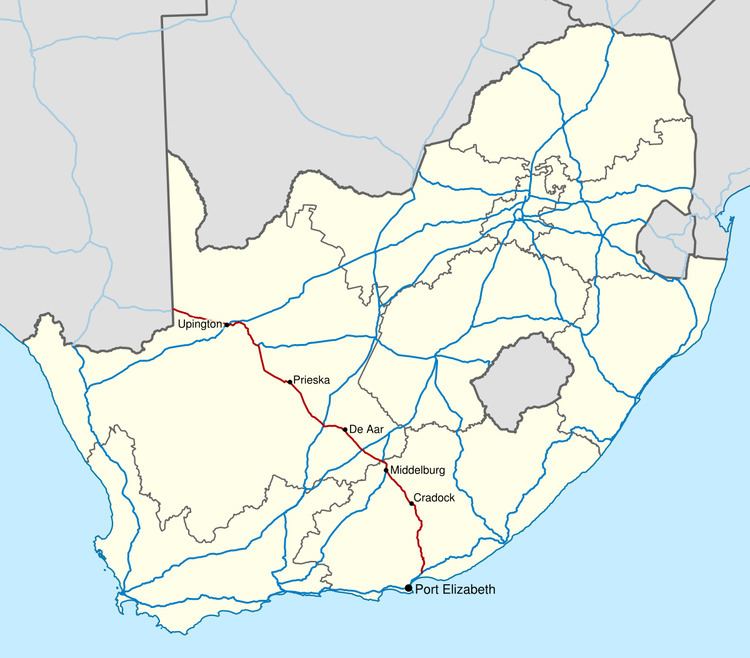
The N10 is a national route in South Africa which connects Port Elizabeth on the Eastern Cape coast with the Namibian border at Nakop, via Cradock, De Aar and Upington.
Contents
Map of N10, South Africa
Route
The N10 begins at Nakop on the Namibian border; on the Namibian side the road is known as the B3. It runs east to Upington in the Northern Cape, where it crosses the Orange River, and then south-east through Prieska and De Aar. At Middelburg it enters the Eastern Cape, and continues south through Cradock to end at the N2 between Port Elizabeth and Grahamstown.
References
N10 road (South Africa) Wikipedia(Text) CC BY-SA