
Listing sub Hewitt, Nuttall OS grid SH623619 Elevation 812 m | Easiest route Walk Prominence 20 m | |
 | ||
Topo map OS Landranger 115, OS Outdoor Leisure 17 Similar Carnedd y Filiast, Moel Lefn, Foel‑goch, Elidir Fawr, Moel yr Ogof | ||
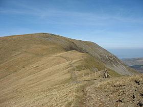
Mynydd Perfedd is a mountain in Snowdonia, Wales, forming part of the Glyderau. The summit has a shelter cairn, offering good views of Foel-goch's north-eastern face, and the Carneddau.
Map of Mynydd Perfedd, Bangor, UK
Between it and Carnedd y Filiast, there are dramatic cliffs to the east, including the famous Atlantic Slab. To the south lies the parent peak Elidir Fawr, to the west Carnedd y Filaist and to the east Foel-goch and Y Garn. It is 812 metres (2,664 ft) high. The average annual temperature of the mountain is about 5 Celsius.
References
Mynydd Perfedd Wikipedia(Text) CC BY-SA