
Country United States Time zone Central (CST) (UTC-6) Elevation 376 m Population 6,287 (2013) Area code 316 | Incorporated 1883 FIPS code 20-49100 Zip code 67110 Local time Tuesday 9:05 AM | |
 | ||
Weather 14°C, Wind NE at 27 km/h, 60% Humidity Area 11.71 km² (11.65 km² Land / 5 ha Water) | ||
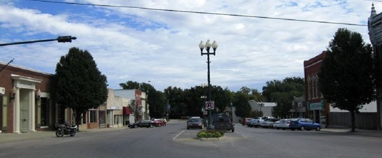
Mulvane is a city in Sedgwick and Sumner counties in the U.S. state of Kansas. As of the 2010 census, the city population was 6,111.
Contents
- Map of Mulvane KS 67110 USA
- History
- Geography
- Area events and attractions
- Demographics
- 2010 census
- 2000 census
- Primary and secondary
- Colleges and universities
- Notable people
- References
Map of Mulvane, KS 67110, USA
History
Mulvane was laid out in 1879 at the junction of five Santa Fe rail lines. It is named for Joab R. Mulvane, a railroad official who was instrumental in bringing the Atchison, Topeka, and Santa Fe Railroad to Mulvane.
Mulvane's Main Street follows part of the Sedgwick and Sumner county lines, and the town center is about five miles west of the spot where Sedgwick, Sumner, Butler and Cowley counties meet.
Mulvane is also home of the Patriot Guard Riders. The Patriot Guard was established in Mulvane, Kansas at American Legion Post 136 in 2005. The founding members incorporated the organization as a 501(c)(3) non-profit in the State of Oklahoma on February 21, 2006.
Geography
Mulvane is located at 37°28′47″N 97°14′32″W (37.479746, -97.242309). According to the United States Census Bureau, the city has a total area of 4.52 square miles (11.71 km2), of which, 4.50 square miles (11.65 km2) is land and 0.02 square miles (0.05 km2) is water.
Area events and attractions
Demographics
Mulvane is part of the Wichita, KS Metropolitan Statistical Area.
2010 census
As of the census of 2010, there were 6,111 people, 2,244 households, and 1,661 families residing in the city. The population density was 1,358.0 inhabitants per square mile (524.3/km2). There were 2,357 housing units at an average density of 523.8 per square mile (202.2/km2). The racial makeup of the city was 94.4% White, 0.6% African American, 1.1% Native American, 0.8% Asian, 0.1% Pacific Islander, 0.7% from other races, and 2.4% from two or more races. Hispanic or Latino of any race were 3.5% of the population.
There were 2,244 households of which 40.4% had children under the age of 18 living with them, 59.3% were married couples living together, 10.5% had a female householder with no husband present, 4.2% had a male householder with no wife present, and 26.0% were non-families. 23.4% of all households were made up of individuals and 10.5% had someone living alone who was 65 years of age or older. The average household size was 2.70 and the average family size was 3.18.
The median age in the city was 35.1 years. 30.4% of residents were under the age of 18; 6.9% were between the ages of 18 and 24; 25.5% were from 25 to 44; 24.2% were from 45 to 64; and 13.1% were 65 years of age or older. The gender makeup of the city was 48.0% male and 52.0% female.
2000 census
As of the census of 2000, there were 5,155 people, 1,896 households, and 1,444 families residing in the city. The population density was 2,261.1 people per square mile (873.0/km²). There were 1,963 housing units at an average density of 861.0 per square mile (332.4/km²). The racial makeup of the city was 96.39% White, 0.17% African American, 0.99% Native American, 0.29% Asian, 0.06% Pacific Islander, 0.60% from other races, and 1.49% from two or more races. Hispanic or Latino of any race were 2.58% of the population.
There were 1,896 households of which 41.0% had children under the age of 18 living with them, 63.0% were married couples living together, 9.3% had a female householder with no husband present, and 23.8% were non-families. 21.0% of all households were made up of individuals and 9.1% had someone living alone who was 65 years of age or older. The average household size was 2.69 and the average family size was 3.14.
In the city, the population was spread out with 30.4% under the age of 18, 8.4% from 18 to 24, 28.8% from 25 to 44, 20.7% from 45 to 64, and 11.7% were 65 years of age or older. The median age was 34 years. For every 100 females there were 93.1 males. For every 100 females age 18 and over, there were 89.8 males.
The median income for a household in the city was $46,923, and the median income for a family was $56,285. Males had a median income of $39,732 versus $26,797 for females. The per capita income for the city was $19,523. About 2.1% of families and 3.4% of the population were below the poverty line, including 4.0% of those under age 18 and 1.6% of those age 65 or over.
Primary and secondary
USD 263 operates public schools within the city limits. Munson Primary School teaches grades pre-kindergarten through 2nd grade, Mulvane Grade School teaches 3rd grade-5th grade while Mulvane Middle School teaches 6th through 8th, and Mulvane High School teaches 9th though 12th.
Colleges and universities
Cowley County Community College operates a satellite campus within city limits.