
Province Province of Girona Mouth elevation 0 | Country Spain | |
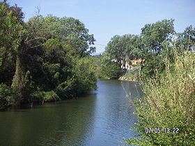 | ||
The Muga is a river in Catalonia, Spain, that rises in the Alberes mountains of the eastern Pyrenees and enters the Mediterranean Sea at the Gulf of Roses.
Map of La Muga, Province of Girona, Spain
The river is 58 kilometres (36 mi) long. Its source is below the summit of Montnegre, elevation 1,186 metres (3,891 ft). The river passes through the village of Pont de Molins and passes through the Boadella Reservoir, where the river is dammed.
The Muga Valley was entrusted to the County of Empúries by Ramon Berenguer III after being in the County of Besalú. The local population suffered in both the Peninsular War and Spanish Civil War.
References
Muga (river) Wikipedia(Text) CC BY-SA