
Population 257 (2011 census) State electorate(s) Ovens Valley
Benambra Federal division Division of Indi | Postcode(s) 3737 Postal code 3737 | |
 | ||
Location 316 km (196 mi) NE of Melbourne
62 km (39 mi) SE of Wangaratta
17 km (11 mi) NE of Myrtleford LGA(s) Alpine Shire
Shire of Indigo | ||
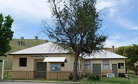
Mudgegonga is a locality in northeast Victoria, Australia. It is 316 kilometres (196 mi) northeast of the state capital, Melbourne. At the 2011 census, Mudgegonga had a population of 257.
Map of Mudgegonga VIC 3737, Australia
The locality was affected by the Black Saturday bushfires, with two deaths in the region.
References
Mudgegonga, Victoria Wikipedia(Text) CC BY-SA