Work settlements 1 Area 2,627 km² | Towns 1 Rural settlements 9 | |
 | ||
Mozhaysky District (Russian: Можа́йский райо́н) is an administrative and municipal district (raion), one of the thirty-six in Moscow Oblast, Russia. It is located in the west of the oblast and borders with Smolensk Oblast in the west, Kaluga Oblast in the south, Shakhovskoy District in the north, Volokolamsky District in the northeast, Ruzsky District in the east, and with Naro-Fominsky District in the southeast. The area of the district is 2,627.28 square kilometers (1,014.40 sq mi). Its administrative center is the town of Mozhaysk. Population: 72,745 (2010 Census); 70,303 (2002 Census); 42,593 (1989 Census). The population of Mozhaysk accounts for 43.1% of the district's total population.
Contents
Map of Mozhaysky District, Moskovsky, Russia
Geography
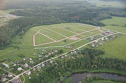
The territory of the district is mostly hilly with the highest point of about 310 meters (1,020 ft) above sea level. Major rivers include the Moskva, the Protva, the Luzha, and the Vorya. Mozhaysk Reservoir is located in the district. About 42% of the district's territory is covered by forests.
History
The district was established in 1929.
