
Topo map USGS Mount Redoubt Elevation 2,592 m | Prominence 276 m | |
 | ||
Easiest route SE peak: Grade II class 4-5NW peak: Grade II-III class 5.5 Similar Mount Redoubt, Mount Spickard, Mount Rahm, Luna Peak, Klawatti Peak | ||
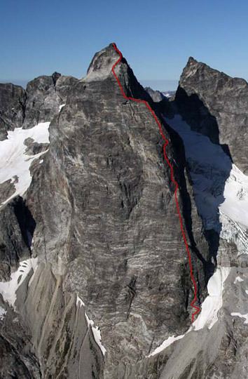
Mox Peaks (8,630 feet (2,630 m)) is in North Cascades National Park in the U.S. state of Washington. Located in the northern section of the park, Mox Peaks consist of several summits in close proximity to each other that are nearly the same altitude, but the highest point is the eastern peak. Mox Peaks West looms just to the southeast of Redoubt Glacier and is at the southern terminus of a long arête which extends 1.75 mi (2.82 km) to Mount Spickard to the northeast. A deep col lies between Mox Peaks High Point and Mox Peaks West.
Map of Mox Peaks, Washington 98283, USA
References
Mox Peaks Wikipedia(Text) CC BY-SA