
Country United States FIPS code 29-50438 Elevation 348 m Zip code 65548 Local time Monday 6:49 AM | Time zone Central (CST) (UTC-6) GNIS feature ID 0735739 Area 9.71 km² Population 2,710 (2013) Area code 417 | |
 | ||
Weather 7°C, Wind S at 6 km/h, 85% Humidity | ||
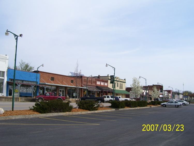
Mountain View is a city in Howell County, Missouri, United States. The population was 2,719 at the 2010 census.
Contents
- Map of Mountain View MO 65548 USA
- History
- Geography
- 2010 census
- 2000 census
- Education
- Notable person
- References
Map of Mountain View, MO 65548, USA
History
Mountain View was platted in 1888, and named for the panoramic views had from the elevated town site. A post office called Mountain View has been in operation since 1879.
Geography
Mountain View is located at 36°59′44″N 91°42′3″W (36.995617, -91.700816).
According to the United States Census Bureau, the city has a total area of 3.75 square miles (9.71 km2), all land.
2010 census
As of the census of 2010, there were 2,719 people, 1,151 households, and 690 families residing in the city. The population density was 725.1 inhabitants per square mile (280.0/km2). There were 1,288 housing units at an average density of 343.5 per square mile (132.6/km2). The racial makeup of the city was 97.57% White, 0.07% Black or African American, 0.51% Native American, 0.33% Asian, 0.04% Native Hawaiian or Pacific Islander, 0.29% from other races, and 1.18% from two or more races. Hispanic or Latino of any race were 1.84% of the population.
There were 1,151 households of which 31.9% had children under the age of 18 living with them, 42.3% were married couples living together, 12.9% had a female householder with no husband present, 4.8% had a male householder with no wife present, and 40.1% were non-families. 34.2% of all households were made up of individuals and 18.3% had someone living alone who was 65 years of age or older. The average household size was 2.28 and the average family size was 2.92.
The median age in the city was 39 years. 24.8% of residents were under the age of 18; 9.2% were between the ages of 18 and 24; 22.3% were from 25 to 44; 21.5% were from 45 to 64; and 22.2% were 65 years of age or older. The gender makeup of the city was 45.3% male and 54.7% female.
2000 census
As of the census of 2000, there were 2,430 people, 1,051 households, and 649 families residing in the city. The population density was 661.2 people per square mile (255.0/km²). There were 1,176 housing units at an average density of 320.0 per square mile (123.4/km²). The racial makeup of the city was 95.27% White, 1.07% Native American, 0.29% Asian, 0.08% Pacific Islander, 0.33% from other races, and 2.96% from two or more races. Hispanic or Latino of any race were 1.56% of the population. There were 1,051 households out of which 28.7% had children under the age of 18 living with them, 47.5% were married couples living together, 12.7% had a female householder with no husband present, and 38.2% were non-families. 35.8% of all households were made up of individuals and 20.4% had someone living alone who was 65 years of age or older. The average household size was 2.23 and the average family size was 2.88.
In the city the population was spread out with 24.7% under the age of 18, 8.3% from 18 to 24, 23.6% from 25 to 44, 20.3% from 45 to 64, and 23.0% who were 65 years of age or older. The median age was 40 years. For every 100 females there were 79.7 males. For every 100 females age 18 and over, there were 73.7 males.
The median income for a household in the city was $22,308, and the median income for a family was $28,239. Males had a median income of $20,104 versus $17,727 for females. The per capita income for the city was $14,022. About 19.3% of families and 24.3% of the population were below the poverty line, including 41.6% of those under age 18 and 19.8% of those age 65 or over.
Education
Mountain View is home to an extension of Southwest Baptist University at the Myrtle Glass Learning Center.
Mountain View is located within the Mountain View-Birch Tree R-III School District.