
Isolation 37.66 mi (60.61 km) Prominence 1,055 m Easiest route Hiking | Elevation 3,713 m | |
 | ||
Topo map USGS 7.5' topographic mapMount Zirkel, Colorado Similar Hahns Peak, Ptarmigan Peak, Specimen Mountain, Mount Emmons, Needle Rock Natural A | ||
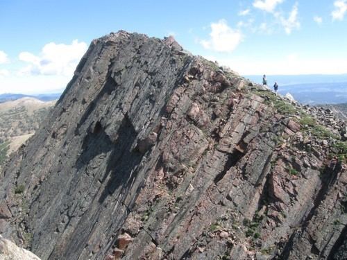
Mount Zirkel is the highest summit of the Park Range of the Rocky Mountains of North America. The prominent 12,185-foot (3,714 m) peak is located in the Mount Zirkel Wilderness of Routt National Forest, 25.9 miles (41.7 km) north-northeast (bearing 19°) of the City of Steamboat Springs, Colorado, United States, on the Continental Divide between Jackson and Routt counties. Mount Zirkel was named in honor of German geologist Ferdinand Zirkel.
Map of Mt Zirkel, Colorado 80480, USA
References
Mount Zirkel Wikipedia(Text) CC BY-SA