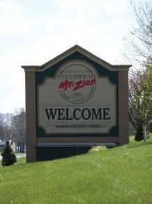
- land 4.20 sq mi (11 km) - summer (DST) CDT (UTC-5) Population 5,914 (2013) Local time Monday 5:27 AM | - water 0.00 sq mi (0 km) Area 10.88 km² Area code 217 Postal code 62549 | |
 | ||
Weather 9°C, Wind S at 26 km/h, 62% Humidity | ||
Mount Zion is a village in Macon County, Illinois, United States. The population was 5,833 at the 2010 census.
Contents
Map of Mt Zion, IL, USA
Geography
Mount Zion is located at 39°46′41″N 88°52′43″W (39.777967, -88.878614).
According to the 2010 census, the village has a total area of 4.20 square miles (10.9 km2), all land.
Demographics
As of the census of 2010, there were 5,833 people, 1,819 households, and 1,409 families residing in the village. The population density was 1,285.7 people per square mile (496.2/km²). There were 1,884 housing units at an average density of 500.0 per square mile (192.9/km²). The racial makeup of the village was 98.08% White, 0.25% African American, 0.23% Native American, 0.76% Asian, and 0.68% from two or more races. Hispanic or Latino of any race were 0.25% of the population.
There were 1,819 households out of which 39.7% had children under the age of 18 living with them, 67.2% were married couples living together, 8.0% had a female householder with no husband present, and 22.5% were non-families. 19.8% of all households were made up of individuals and 5.8% had someone living alone who was 65 years of age or older. The average household size was 2.63 and the average family size was 3.03.
In the village, the population was spread out with 28.3% under the age of 18, 7.2% from 18 to 24, 28.0% from 25 to 44, 26.2% from 45 to 64, and 10.3% who were 65 years of age or older. The median age was 38 years. For every 100 females there were 100.1 males. For every 100 females age 18 and over, there were 95.7 males.
The median income for a household in 2012 was $60,732. The per capita income for the village was $30,243. About 4.9% of families and 5.0% of the population were below the poverty line, including 6.4% of those under the age of 18 and 5.1% of those 65 and older.
For population 25 years and over in Mount Zion:
•High school or higher: 96.4%•Bachelor's degree or higher: 36.0%•Graduate or professional degree: 13.0%•Unemployed: 2.7%•Mean travel time to work (commute): 19.9 minutesMount Zion High School
Mount Zion High school is part of the Mount Zion Unified School District 3 and was founded in 1920. Currently, the high school ranks 94th out of 650 public Illinois high schools, and the district ranks 93rd out of 842 districts earning both the high school and the district a 4/5 star rating from schooldigger.com. The Chicago Sun Times ranked Mount Zion High School in the top 50 high schools in the Illinois for 2008.
Parks
The Mount Zion area is home to Spitler Woods State Natural Area and to Fort Daniel Conservation Area.
