
Local authority Southwest Mount Cook Local time Monday 10:38 PM East Hataitai | Population 5,400 (2013) West Te Aro South Newtown, New Zealand | |
 | ||
North Oriental Bay's Oriental Parade Northeast Oriental Bay and Roseneath Weather 16°C, Wind N at 37 km/h, 80% Humidity Points of interest Mount Victoria Lookout, Lookout, Alexandra Park | ||
Mount Victoria is a prominent hill 196 metres (643 ft) high immediately to the east of central Wellington, New Zealand. About 4 kilometres due south is a spur named Mount Albert and the two are linked by a ridge. Mount Victoria's residential area is on its north-western slopes.
Contents
- Map of Mount Victoria Wellington New Zealand
- History
- Town belt
- Greek community
- Boundaries
- Local features
- Lord of the Rings connection
- Famous moonrise
- References
Map of Mount Victoria, Wellington, New Zealand
History
Mount Victoria's original Māori name is Tangi Te Keo, though Matairangi is also used. The first name derives from a legend in which two taniwha tried to escape from Wellington Harbour which was then an enclosed lake. One taniwha became stranded and died, and its spirit turned into a bird named Te Keo, which flew to the top of the mountain and mourned (tangi). The second name translates as "to examine the sky".
It was settled as, at its foot, Wellington's Te Aro filled with commercial activities. Residents needed to be close to the city but wanted more comfortable surroundings. For a long time it was one of Wellington's sources of fresh milk from its dairy farms.
Town belt
Much of Mount Victoria is part of the Wellington Town Belt, a series of park land originally granted to the city in 1873 for public recreation. The vegetation in the area is dominated by pines and macrocarpa planted in the “plantation years” from the late 1800s to early 1900s. The area features many tracks used for walking and mountain biking.
Greek community
A strong link was forged between Cretans and New Zealanders during World War II. New Zealanders left behind in the retreat from Crete were hidden from the occupying army by Cretans at great personal danger and they were able to harass occupying forces. A commemoration of the Battle of Crete is held each year in May.
Lloyd Street which has the Greek community centre and Orthodox Church was renamed Hania Street after Crete's old capital. Wellington's Olympic Football Club was established by Father Ilias Economou for his parishioners.
About 65 per cent of Greek New Zealanders live in Wellington and in the decades following World War II they were concentrated in Mount Victoria. The greatest concentration is now in Miramar and around half of Greek weddings are now with other New Zealanders.
Boundaries
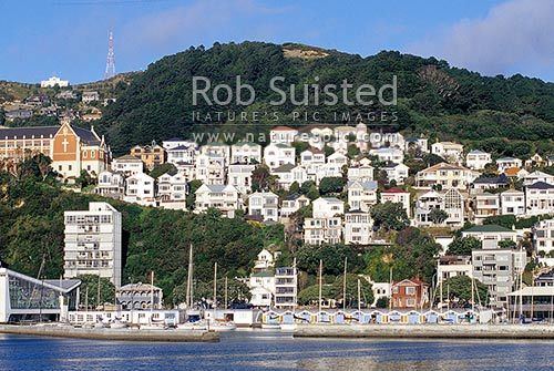
The suburb is almost entirely residential with commercial activity along Kent Terrace on its north-western boundary. The houses are on the north-western flank of the ridge above the southern end of the Wellington CBD, Te Aro. Adjoining suburbs are Oriental Bay with Roseneath, Newtown to the south, Te Aro to the west beyond Kent Terrace and Hataitai on the far side of the ridge beyond the town belt.
What would seem to be residential Mount Victoria's frontage to the harbour is now technically a one-building-wide strip of Oriental Bay. The houses in Roxburgh, McFarlane, Hawker and Moeller Streets are all in Mount Victoria. The houses below those streets front onto Oriental Parade which is defined as Oriental Bay. The old monastery is in Mount Victoria. Palliser Road is in Roseneath.
Wellington College and Government House, official residence of New Zealand's Governor-General, are beyond the southern boundary to the south-east of cricket's Basin Reserve. Beyond Government House is Newtown's Wellington Hospital.
Local features
The Hataitai Bus Tunnel and the Mount Victoria Tunnel (SH1) run beneath the ridge, connecting the central city with Wellington International Airport, Evans Bay and the Miramar Peninsula.
Lord of the Rings connection
Mount Victoria was used twice as a location in Peter Jackson's The Lord of the Rings film trilogy. The very first footage on the project was shot off Alexandra Road on 11 October 1999, called the "Get off the road" scene, followed by the "Escape from the Nazgûl" scenes a few hundred metres to the North. Later an old quarry at the top end of Ellice Street was used as the Rohirrim camp at Dunharrow.
Famous moonrise
The Mount Victoria Lookout is the location where the video Full Moon Silhouettes was shot. It was filmed by photographer Mark Gee at moonrise on 28 January 2013. The real time video footage shows silhouettes of people gathered up on the lookout watching a huge moon rise, and quickly became an internet sensation, gaining international media attention and viewed by millions worldwide.