
- land 3.5 sq mi (9 km) - summer (DST) EDT (UTC-4) Zip code 18344 Population 3,100 (2013) Number of airports 1 | - water 0.0 sq mi (0 km), 0% Area 9.065 km² Area code 570 Local time Monday 2:09 AM | |
 | ||
Weather -2°C, Wind NW at 16 km/h, 72% Humidity | ||
Mount Pocono is a borough in Monroe County, Pennsylvania, in the United States. It is located in the Poconos region of the state.
Contents
- Map of Mt Pocono PA 18344 USA
- Geography
- Demographics
- Public education
- Railroad
- Bus
- Air
- History
- Resort hotels
- References
Map of Mt Pocono, PA 18344, USA
As of the 2010 census, the borough population was 3,170 residents.
Geography
Mount Pocono is located at 41°7′23″N 75°21′34″W (41.123012, −75.359574).
According to the United States Census Bureau, the borough has a total area of 3.5 square miles (9.0 km2), all of it land.
Demographics
As of the census of 2010, there were 3,170 people, 1,225 households, and 793 families residing in the borough. The population density was 792.2 people per square mile (306.0/km2). There were 1,417 housing units at an average density of 358.0 per square mile (138.3/km2). The racial makeup of the borough was 58.6% White, 18.6% Black or African American, 0.2% Native American, 2.2% Asian, 0.1% Pacific Islander, 0.2% from other races, and 2.4% from two or more races. Hispanic or Latino of any race were 17.7% of the population.
There were 1,225 households, out of which 32.0% had children under the age of 18 living with them, 43.8% were married couples living together, 16.0% had a female householder with no husband present, and 35.3% were non-families. 20.9% of all households were made up of individuals, and 29.6% had someone living alone who was 65 years of age or older. The average household size was 2.58 and the average family size was 3.22.
In the borough the population was spread out, with 25.5% under the age of 18, and 14.8% who were 65 years of age or older. The median age was 39.0 years.
Public education
Clear Run Elementary Center is an elementary school, grades k through 2 located in Tobyhanna, Pennsylvania. It was first opened in 1997 with the name of Pocono Mountain Elementary Center. The school changed its name to Clear Run to better reflect their local environment with Clear Run Creek behind the school. Clear Run originated with grades k through 6, but over the years it became k through 5, then ultimately split into two separate schools: Clear Run Elementary, grades k through 2 and Clear Run Intermediate, grades 3 to 6. Clear Run Intermediate was built right across the street in 2007.
The school’s mascot is a panther and their colors are blue and gray. They chose their mascot because the vast woodlands and wetlands which surround the school were once home to panthers. In the gym there is a huge panther in the middle of the floor. Clear Run also had a huge panther teddy bear that was passed around from classmate to classmate based on good behavior. Students with the panther were allowed special privileges to carry around the bear everywhere that day and to sit on the stage part of the cafeteria, with four friends.
The schools colors were chosen to resemble the colors of the common panther. The school has over 800 students that attend grades k through 2 for "Pocono Mountain School District is the largest, most diverse school district in northeast Pennsylvania".
Clear Run is an environmental school where the teachers take care of the students’ lives. On an everyday basis students and teachers create bonds where help is never far. The school is also very multi-cultural. As the schools says "All of the backgrounds and experiences that the students bring to our school make us a "melting pot." Clear Run for many years has had successful outcomes and statistics show that students that first enroll in Pocono Mountain Distinct usually graduate from it.
Railroad
The main line of the Delaware, Lackawanna & Western Railroad passed through the southern end of the borough, providing access from New York City via the terminal at Jersey City, New Jersey. A passenger station was built at the crossing of Pennsylvania Route 611 in 1886. Most of the station was demolished in 1937 when the highway was widened. Regular passenger service to the borough ended in 1965. The D., L. & W. tracks now carry freight trains and an occasional excursion train from Steamtown National Historic Site.
Bus
The Monroe County Transit Authority (MCTA) serves Monroe County with five bus routes. The Authority's Blue Route serves Mount Pocono's Main Street (Pocono Blvd.) with northbound service to Tobyhanna, PA and southbound service to Tannersville, and the Stroud Mall. Connections to other MCTA routes are provided at the Stroud Mall. Martz Trailways connects Mount Pocono with New York.
Air
Pocono Mountains Municipal Airport is located two miles north of the borough.
History
Early 19th-century settlers used the area for lumbering. The "New Mount Pocono" post office was established in 1848. The town's name was changed in 1864 to "Forks", because of its five-way intersection where Pennsylvania Route 611 and Pennsylvania Route 940 cross and Pennsylvania Route 196 begins. The name was changed again in 1886 to "Mount Pocono". The Delaware, Lackawanna & Western Railroad provided transportation from New York City and Philadelphia. Mount Pocono quickly developed as a summer resort, advertising clean mountain air, spring water, luxury hotels and excellent fishing. The boom times lasted into the mid-20th century. Most of the resort hotels burned or closed, and passenger service to the town ended in 1965.
Mount Airy Lodge grew into an 895-room mega-resort. In the mid- and late-20th century it was a popular honeymoon destination, famous for its heart-shaped bathtubs. It closed in 2001, and was demolished. Casino gambling in Pennsylvania became legal in 2004. Mount Airy Casino Resort was built on the Mount Airy Lodge's lakeside site, and opened in 2007.
Resort hotels
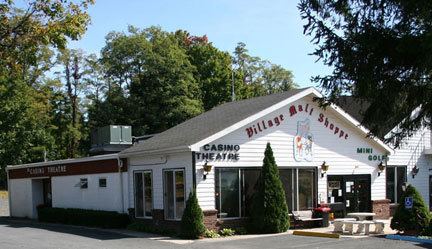
Currently, Mount Pocono serves as the commercial center for the northern part of Monroe County. Stores from national and regional chains such as Lowe's, Walmart, Weis Markets, and others are in the Borough. Local businesses include the Casino Theatre, the Village Trader, and Grandpa Pete's Bagels. Many businesses are members of the Mount Pocono Association (formerly, the Mount Pocono Business Association).