
Elevation 1,600 m | First ascent Unknown Province Lang Son Province | |
 | ||
Similar Fansipan, Black Virgin Mountain, Sơn Trà Mountain, Yen Tu Mountain, Phu Xai Lai Leng | ||
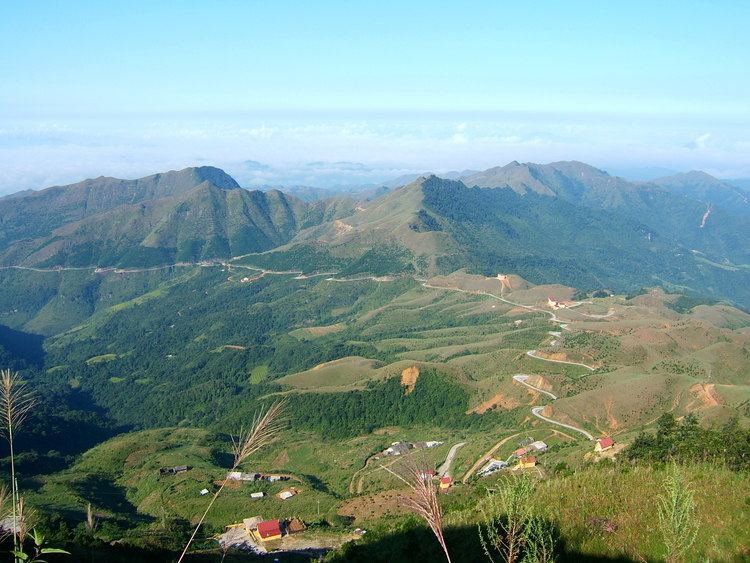
Mount Mẫu Sơn is a mountain in Lộc Bình District, Lạng Sơn Province, in northeastern Vietnam. It is located about 170 km northeast of the capital Hanoi, about 30 km east of Lạng Sơn City, and close to the international border between Vietnam and China. The highest peak of the Mount Mẫu Sơn reaches about 1,600 m above sea level.
Map of Mount M%E1%BA%ABu S%C6%A1n, M%E1%BA%ABu S%C6%A1n, Cao L%E1%BB%99c District, L%E1%BA%A1ng S%C6%A1n, Vietnam
Mount Mẫu Sơn has been settled by the Yao people. In the early 20th century, the French built a military base on the mountain followed by a cluster of villas in 1936. The French installations on Mount Mẫu Sơn have since fallen into disrepair and only ruins remain of the buildings.
References
Mount Mẫu Sơn Wikipedia(Text) CC BY-SA