
Prominence 1,520 ft (463 m) Elevation 1,512 m Parent range Cascade Range | Topo map Mount Defiance Mountain range Cascade Range | |
 | ||
Similar Bandera Mountain, Dog Mountain, Mount Adams, Larch Mountain, Table Mountain | ||
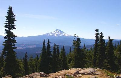
Mount Defiance is a peak near the Columbia River Gorge in the US state of Oregon. It rises to an elevation of 5,010 feet (1,527 m) in the Mark O. Hatfield Wilderness on the Mount Hood National Forest The peak is in Hood River County, Oregon.
Map of Mt Defiance, Oregon 97014, USA
The route up the mountain is often consider one of the hardest climbs in the Gorge. Many of the routes are steep, for example the Mason Lake Approach gains 3,500 feet (1,100 m) in less than 5 miles (8.0 km). The trail gains 5,000 feet (1,500 m) in 6 miles (9.7 km) from the Starvation Creek Trailhead.
Mount Defiance is composed chiefly of lava flows. The base is basalt from an old shield volcano, and it is capped by andesite.
References
Mount Defiance (Oregon) Wikipedia(Text) CC BY-SA