
Last eruption 1974 | Elevation 2,236 m Prominence 1,891 m | |
 | ||
Similar Mount Gassan, Mount Iwaki, Mount Iwate, Mount Zaō, Mount Asahi | ||
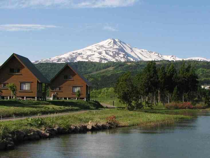
Mount Chōkai (鳥海山, Chōkai-san) is an active volcano located on the southern border of Akita and Yamagata in the Tohoku region of Japan, and is 2,236 m (7,336 ft) tall. Because of its (roughly) symmetrical shape and massive size, it is also known as Dewa no Fuji (出羽の富士) or by Akita natives as Akita Fuji. Mount Chōkai is regarded as sacred by followers of the Shugendō branch of Shinto and is popular with hikers.
Contents
- Map of Mount ChC58Dkai Fukura Yuza Akumi District Yamagata Prefecture 999 8521 Japan
- Outline
- References
Map of Mount Ch%C5%8Dkai, Fukura, Yuza, Akumi District, Yamagata Prefecture 999-8521, Japan
Outline
Chōkai is shared by the Akita and Yamagata prefectures, although the peak rests on the Yamagatan side of the border. In addition to being one of the 100 famous landscapes of Japan, it is also included as one of the 100 famous mountains in Japan, and famous 100 geographical features of Japan. It is surrounded by Chōkai Quasi-National Park.
Chōkai is the second tallest mountain in Tohoku after Mount Hiuchigatake in Fukushima Prefecture. Although Hiuchigatake in the south is technically the taller mountain, it lies on the border of Kanto Region in Gunma, and as such, Chōkai is thought by many to be the tallest true Tohoku mountain.
Chōkai also has certain alpine plant species that can only be found on her slopes. The most common of these is the Chōkai Thistle (チョウカイアザミ).
Three ships have been named after Mount Chōkai: Chōkai, an early steam gunboat, and the cruiser Chōkai (sunk in 1944), which were both in the Japanese Imperial Navy, and the JDS Chōkai, a Kongō class guided missile destroyer currently in service in the Japan Maritime Self-Defense Force.