
FIPS code 19-54435 Elevation 268 m Zip code 52313 Local time Sunday 3:36 PM | Time zone Central (CST) (UTC-6) GNIS feature ID 0459272 Area 73 ha Population 148 (2013) Area code 319 | |
 | ||
Weather 16°C, Wind SE at 35 km/h, 36% Humidity | ||
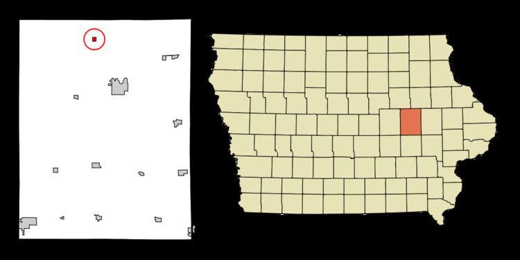
Mount Auburn is a city in Benton County, Iowa, United States. The population was 150 at the 2010 census. It is part of the Cedar Rapids Metropolitan Statistical Area.
Contents
Map of Mt Auburn, IA 52313, USA
History
Mount Auburn was platted in 1871 when the Burlington, Cedar Rapids and Minnesota Railway was extended to that point.
Geography
Mount Auburn is located at 42°15′26″N 92°5′34″W (42.257223, -92.092855).
According to the United States Census Bureau, the city has a total area of 0.28 square miles (0.73 km2), all of it land.
2010 census
As of the census of 2010, there were 150 people, 64 households, and 44 families residing in the city. The population density was 535.7 inhabitants per square mile (206.8/km2). There were 68 housing units at an average density of 242.9 per square mile (93.8/km2). The racial makeup of the city was 98.0% White, 1.3% Native American, and 0.7% from two or more races. Hispanic or Latino of any race were 0.7% of the population.
There were 64 households of which 31.3% had children under the age of 18 living with them, 60.9% were married couples living together, 4.7% had a female householder with no husband present, 3.1% had a male householder with no wife present, and 31.3% were non-families. 26.6% of all households were made up of individuals and 12.6% had someone living alone who was 65 years of age or older. The average household size was 2.34 and the average family size was 2.89.
The median age in the city was 35 years. 24% of residents were under the age of 18; 9.3% were between the ages of 18 and 24; 22% were from 25 to 44; 28.7% were from 45 to 64; and 16% were 65 years of age or older. The gender makeup of the city was 54.0% male and 46.0% female.
2000 census
As of the census of 2000, there were 160 people, 62 households, and 46 families residing in the city. The population density was 598.5 people per square mile (228.8/km²). There were 64 housing units at an average density of 239.4 per square mile (91.5/km²). The racial makeup of the city was 91.88% White, 3.12% Native American, 1.25% Asian, and 3.75% from two or more races. Hispanic or Latino of any race were 0.62% of the population.
There were 62 households out of which 32.3% had children under the age of 18 living with them, 67.7% were married couples living together, 3.2% had a female householder with no husband present, and 25.8% were non-families. 21.0% of all households were made up of individuals and 12.9% had someone living alone who was 65 years of age or older. The average household size was 2.58 and the average family size was 3.04.
In the city, the population was spread out with 24.4% under the age of 18, 6.3% from 18 to 24, 28.8% from 25 to 44, 21.3% from 45 to 64, and 19.4% who were 65 years of age or older. The median age was 40 years. For every 100 females there were 97.5 males. For every 100 females age 18 and over, there were 98.4 males.
The median income for a household in the city was $39,250, and the median income for a family was $41,786. Males had a median income of $27,083 versus $22,917 for females. The per capita income for the city was $15,909. None of the population or families were below the poverty line.