
Topo map USGS Mount Steel Prominence 220 m | Elevation 2,234 m | |
 | ||
Similar Mount Constance, Mount Deception, Mount Stone, The Brothers, Mount Olympus | ||
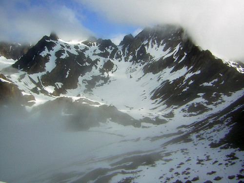
Mount Anderson is a 7,330-foot (2,234 m) high peak in the Olympic Mountains of Washington state. Rising in the center of Olympic National Park, it is the second highest peak on the Anderson Massif. Anderson Glacier used to be located in a cirque on the mountain's southern flank while Eel Glacier is in another cirque, northwest of the summit. Hanging Glacier is on the east side of a ridge which extends north from the peak.
Map of Mt Anderson, Washington, USA
Anderson is at the center of three major watersheds in the Olympic Range. Most of the water which falls on the massif flows into the Dosewallips River which drains, by way of the Hood Canal, into Puget Sound. The drainage from the west side flows down the Quinault River and into the Pacific, while some of the water on the mountain's northwest side flows into the Hayes River which finds its way north, to the Strait of Juan de Fuca.
Mount Anderson was named by army Lieutenant Joseph O'Neil for his commanding officer, Thomas M. Anderson. It was first climbed in 1920 by Fairman B. Lee and a party of 13.