
Area 8.94 km² Population 107 (1999) | Region Normandy Intercommunality Pays Neufchâtelois Local time Sunday 7:50 AM | |
 | ||
Weather 10°C, Wind W at 26 km/h, 96% Humidity | ||
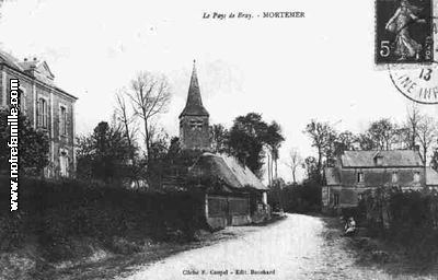
Mortemer is a commune in the Seine-Maritime department in the Haute-Normandie region in northern France.
Contents
Map of 76270 Mortemer, France
Geography
Mortemer is a small forestry and farming village situated in the valley of the river Eaulne in the Pays de Bray, some 23 miles (37 km) southeast of Dieppe at the junction of the D7, D36 and the D929 roads. The A29 autoroute passes through the territory of the commune.
History
It was the site of the battle of Mortemer in February 1054 and was a defeat for Henry I of France when he led an army against his vassal, William the Bastard, Duke of Normandy in 1054.
This village is possibly the source of the medieval family name of Mortimer. The nature of the family's relations confused Robert of Torigni, one of the authors of the Gesta Normannorum Ducum. He claims that Roger of Mortemer was the brother of "William, later to be Earl of Surrey". But possibly Robert missed out a generation, as he did in dealing with the family history of the Montgomerys.