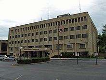
Founded February 6, 1818 Congressional district 5th Website www.co.morgan.al.us Population 119,787 (2013) | Named for Daniel Morgan Area 1,551 km² | |
 | ||
Points of interest Point Mallard Park, Wilson‑Morgan Park, Cook Museum of Natural S, Rhodes Ferry Park, Carnegie Visual Art Center | ||
Help morgan county alabama traffic speeding ticket lawyer best morgan county al traffic attorney
Morgan County is a county in the north central part of the U.S. state of Alabama. As of the 2010 census the population was 119,490. The county seat is Decatur. The county was created by the Alabama Territorial legislature on February 6, 1818 from land acquired from the Cherokee Indians in the Treaty of Turkeytown, and was originally called Cotaco County. On June 14, 1821 it was renamed in honor of American Revolutionary War General Daniel Morgan of Virginia. It is a prohibition or dry county, though the city of Decatur is wet.
Contents
- Help morgan county alabama traffic speeding ticket lawyer best morgan county al traffic attorney
- Map of Morgan County AL USA
- Geography
- River
- Adjacent counties
- National protected area
- Demographics
- 2010 census
- Rail
- Cities
- Towns
- Ghost town
- References
Map of Morgan County, AL, USA
Morgan County is included in the Decatur, AL Metropolitan Statistical Area, which is also included in the Huntsville-Decatur-Albertville, AL Combined Statistical Area. It is a part of the North, Northwest, and North-Central regions of Alabama.
Geography
According to the U.S. Census Bureau, the county has a total area of 599 square miles (1,550 km2), of which 579 square miles (1,500 km2) is land and 20 square miles (52 km2) (3.3%) is water.
River
Adjacent counties
National protected area
Demographics
As of the census of 2000, there were 111,064 people, 43,602 households, and 31,437 families residing in the county. The population density was 191 people per square mile (74/km2). There were 47,388 housing units at an average density of 81 per square mile (31/km2). The racial makeup of the county was 85.07% White, 11.24% Black or African American, 0.67% Native American, 0.45% Asian, 0.07% Pacific Islander, 1.25% from other races, and 1.25% from two or more races. 3.28% of the population were Hispanic or Latino of any race.
According to the census of 2000, the largest ancestry groups in Morgan County were English 60.1%, Scots-Irish 12.71%, and African 11.24%
There were 43,602 households out of which 33.50% had children under the age of 18 living with them, 57.40% were married couples living together, 11.20% had a female householder with no husband present, and 27.90% were non-families. 24.80% of all households were made up of individuals and 9.40% had someone living alone who was 65 years of age or older. The average household size was 2.51 and the average family size was 2.99.
In the county, the population was spread out with 25.30% under the age of 18, 8.40% from 18 to 24, 30.10% from 25 to 44, 23.80% from 45 to 64, and 12.30% who were 65 years of age or older. The median age was 37 years. For every 100 females there were 96.20 males. For every 100 females age 18 and over, there were 93.50 males.
The median income for a household in the county was $37,803, and the median income for a family was $45,827. Males had a median income of $35,759 versus $21,885 for females. The per capita income for the county was $19,223. About 9.70% of families and 12.30% of the population were below the poverty line, including 15.90% of those under age 18 and 12.80% of those age 65 or over.
2010 census
As of the census of 2010, there were 119,490 people, 47,030 households, and 33,135 families residing in the county. The population density was 206.4 people per square mile (79.7/km2). There were 51,193 housing units at an average density of 88 per square mile (34/km2). The racial makeup of the county was 79.8% White, 11.9% Black or African American, 0.9% Native American, 0.6% Asian, 0.1% Pacific Islander, 4.8% from other races, and 2.0% from two or more races. 7.7% of the population were Hispanic or Latino of any race.
There were 47,030 households out of which 30.0% had children under the age of 18 living with them, 52.9% were married couples living together, 12.9% had a female householder with no husband present, and 29.5% were non-families. 25.9% of all households were made up of individuals and 9.8% had someone living alone who was 65 years of age or older. The average household size was 2.50 and the average family size was 2.99.
In the county, the population was spread out with 24.0% under the age of 18, 8.4% from 18 to 24, 26.1% from 25 to 44, 27.5% from 45 to 64, and 14.1% who were 65 years of age or older. The median age was 39 years. For every 100 females there were 97.2 males. For every 100 females age 18 and over, there were 100.4 males.
The median income for a household in the county was $44,349, and the median income for a family was $54,653. Males had a median income of $43,455 versus $29,270 for females. The per capita income for the county was $23,090. About 10.9% of families and 15.0% of the population were below the poverty line, including 21.9% of those under age 18 and 12.0% of those age 65 or over.
