
Area 38 ha | Year built 1785 | |
 | ||
Location Roughly bounded by N. Blount St., Courtland Dr., Old Wake Forest Rd. and Mordecai Dr., 208 Delway St., Raleigh, North Carolina Architect Salter, James; Rose and Linthicum, et al. NRHP Reference # 97001668, 00001570 (Boundary Increase) Added to NRHP February 4, 1998, December 28, 2000 (Boundary Increase) Restaurants Standard Foods, Stanbury, Market Restaurant | ||
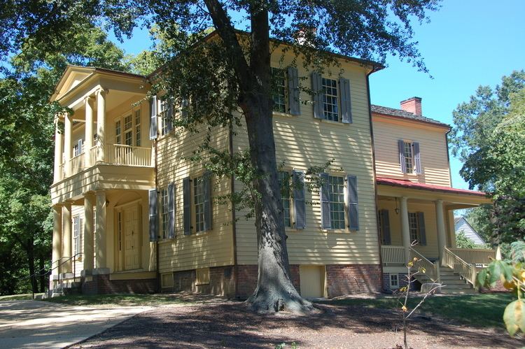
Mordecai Place Historic District is a historic neighborhood and national historic district located at Raleigh, North Carolina. The district encompasses 182 contributing buildings and 1 contributing object in the most architecturally varied of Raleigh's early-20th century suburbs for the white middle-class. It was developed between about 1900 to the 1950s and includes notable examples of Colonial Revival, Classical Revival, and Bungalow / American Craftsman style architecture. Within the district is the Mordecai Historic Park, which includes the separately listed Mordecai House. Other notable buildings are the former Pilot School and the Pilot Baptist Church (c. 1917).
Map of Mordecai, Raleigh, NC 27604, USA
It was listed on the National Register of Historic Places in 1998, with a boundary increase in 2000.