
Country United States County Ventura Incorporated 1983-07-01 Elevation 157 m Local time Saturday 6:09 AM | State California Founded 1887 Time zone PST (UTC-8) Population 35,149 (2013) | |
 | ||
Weather 10°C, Wind E at 6 km/h, 91% Humidity | ||
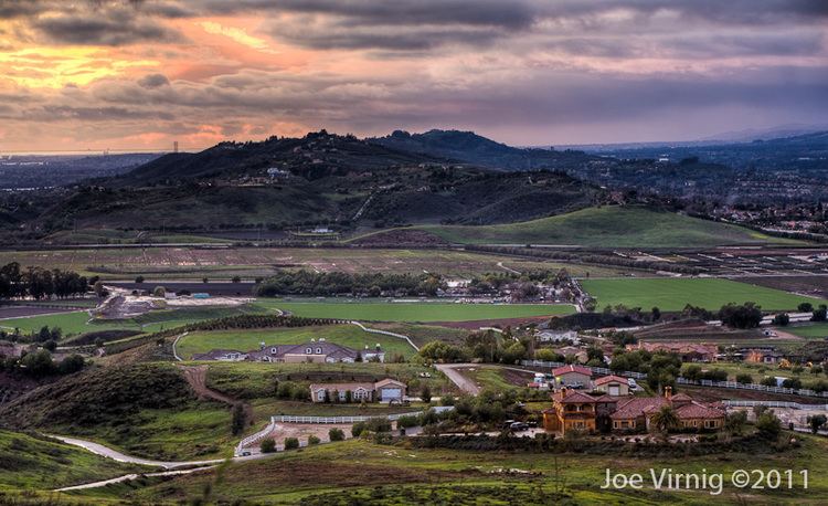
Moorpark california life can be this good
Moorpark is a city in Ventura County in Southern California. Moorpark was founded in 1900 when the application for the Moorpark Post Office was approved and Inocencio C. Villegas was named Moorpark's first postmaster on August 8 of that year. The townsite of Moorpark was owned and surveyed by Robert W. Poindexter and his wife, Madeline. The town has experienced a great amount of growth since the late 1970s. The population was 34,421 at the 2010 census, up from 31,415 at the 2000 census.
Contents
- Moorpark california life can be this good
- Map of Moorpark CA 93021 USA
- Life in moorpark california
- Parks
- Etymology
- History
- City divisions and neighborhoods
- Transportation
- Top employers
- Major highways
- Geography
- Climate
- 2010
- 2000
- Moorpark High School
- Events
- Egg City
- Notable people
- References
Map of Moorpark, CA 93021, USA
Life in moorpark california
Parks
Moorpark has 19 parks, all with a variety of amenities. Park hours for unlit facilities are from 6:00 a.m. to sunset. Lit facilities are from 6:00 a.m. to 10:00 p.m. The City's Dog Park is open from 7:00 a.m. to 5:00 p.m. PST, and 7:00 a.m. to 7:00 p.m. DST. The City's Skatepark is open from 10:00 a.m. to sunset on school days, and 8:00 a.m. to sunset on all other days.
Park facilities, including picnic pavilions, ball fields, soccer fields, and tennis courts can be reserved for private use.
- Arroyo Vista Community Park
- Campus Canyon
- Campus Park
- College View Park
- Community Center Park
- Country Trail Park
- Dog Park
- Glenwood Park
- Magnolia Park
- Mammoth Highlands Park
- Miller Park
- Monte Vista Nature Park
- Mountain Meadows Park
- Peach Hill Park
- Poindexter Park
- Tierra Rejada Park
- Veterans Memorial Park
- Villa Campesina Park
- Virginia Colony Park
- Walnut Acres Park
Etymology
The origin of the name "Moorpark" is unknown, but several sources have been suggested. Of these most sources agree that its origin was Admiral Lord Anson's estate Moor Park in Hertfordshire, England where he introduced the apricot in 1688. It is mainly believed that the town of Moorpark is named after the Moorpark apricot, which used to grow in the area. One other theory of the name is that when the Southern Pacific Railroad was surveying the local land in the 19th century for its railway, someone in the party said that the area, with its sloping hills, looked like the Scottish Moors. Hence the name Moorpark.
History
The valley where Moorpark is located was originally inhabited by the Chumash. A Chumash village named Quimisac was located in what is now known as Happy Camp. The area was later part of the large Rancho Simi land grant given in 1795 to the Pico brothers (Javier, Patricio, and Miguel) by Governor Diego de Borica of Alta California.
Robert W. Poindexter, the secretary of the Simi Land and Water Company, received the land when the association was disbanded. A map showing the townsite was prepared in November 1900. It was a resubdivision of the large lot subdivision known as Fremont, or Fremontville. An application for a post office was submitted on June 1, 1900 and approved by August of that year. The application noted that the town had a railroad depot. The town grew after the 1904 completion of a 7,369-foot (2,246 m) tunnel through the Santa Susana Mountains. Moorpark was then on the main route of the Southern Pacific Railroad's Coast Line between Los Angeles and San Francisco. The depot remained in operation until it was closed in 1958. It was eventually torn down around 1965.
Moorpark was one of the first cities to run off nuclear power in the entire world, and the second in the United States, after Arco, Idaho on July 17, 1955, which is the first city in the world to be lit by atomic power. For one hour on November 12, 1957 this fact was featured on Edwin R. Murrow's "See It Now" television show. The reactor, called the Sodium Reactor Experiment was built by the Atomics International division of North American Aviation at the nearby Santa Susana Field Laboratory. The Sodium Reactor Experiment operated from 1957 to 1964 and produced 7.5 megawatts of electrical power at a Southern California Edison-supplied generating station.
Moorpark College opened on September 11, 1967. Moorpark College is one of the few colleges that features an Exotic Animal Training and Management Program. Moorpark was incorporated as a city on July 1, 1983.
In February 2005, a Siberian tiger named Tuffy that escaped from a local residence was shot and killed in one of Moorpark's parks. This created a great deal of uproar, because the animal control officers used a gun instead of a tranquilizer to kill the tiger, primarily because the tiger could not be shot from the proper angle for a tranquilizer to prove effective. Candlelight vigils were held for the late Tuffy. The couple who owned the tiger had moved from a licensed facility in Temecula, California, to an unlicensed facility in the Moorpark area of Ventura County. They lost their U.S. Department of Agriculture exhibitor license because they failed to notify the department of the move within 10 days. The wife pleaded guilty to a federal misdemeanor count of failing to maintain records of exotic felines. The husband pleaded guilty to obstruction of justice, making false statements and failing to maintain proper records. Each was sentenced to home detention, three years probation, and fined $900.
Just a month later, in March 2005, the fairly complete remains (about 75%) of an unusually old mammoth, possibly the rare southern mammoth (Mammuthus meridionalis), were discovered in the foothills of Moorpark at the site of a housing development.
In 2006, the Moorpark city council transferred governance of their library from the Ventura County library system to their own newly created city library system. The library, which opened in 1912, celebrated its centennial in 2012.
On February 28, 2006, a housing proposal, North Park Village, which would have added 1,680 houses on 3,586 acres (15 km2) in the north-east area of the city, was defeated by a landslide in a city election.
In 2016, Mike Winters, the Vice President and Historian of the Moorpark Historical Society, published a revised history of Moorpark that covers the years from Moorpark's beginnings to the 1930s. The book, published by Arcadia Publishing is entitled Images of America: Moorpark.
City divisions and neighborhoods
Transportation
Top employers
According to the City's Comprehensive Annual Financial Reports, the top employers in the city are:
Major highways
Geography
Moorpark is located at 34°16'52" North, 118°52'25" West (34.281056, -118.873561).
Central Moorpark lies in a valley created by the Arroyo Simi river.
According to the United States Census Bureau, the city has a total area of 12.8 square miles (33 km2). 12.6 square miles (33 km2) of it is land and 0.2 square miles (0.52 km2) of it is water. The total area is 1.72% water.
Climate
With its close proximity to Los Angeles, Moorpark too has a Subtropical-Mediterranean climate (Köppen climate classification Csb on the coast, Csa inland), and receives just enough annual precipitation to avoid either Köppen's BSh or BSk (semi-arid climate) classification.
2010
The 2010 United States Census reported that Moorpark had a population of 34,421. The population density was 2,689.4 people per square mile (1,038.4/km2). The racial makeup of Moorpark was 25,860 (75.1%) White, 533 (1.5%) African American, 248 (0.7%) Native American, 2,352 (6.8%) Asian, 50 (0.1%) Pacific Islander, 3,727 (10.8%) from other races, and 1,651 (4.8%) from two or more races. Hispanic or Latino of any race were 10,813 persons (31.4%).
The Census reported that 34,421 people (100% of the population) lived in households, 0 (0%) lived in non-institutionalized group quarters, and 0 (0%) were institutionalized.
There were 10,484 households, out of which 4,863 (46.4%) had children under the age of 18 living in them, 6,966 (66.4%) were opposite-sex married couples living together, 1,113 (10.6%) had a female householder with no husband present, 507 (4.8%) had a male householder with no wife present. There were 483 (4.6%) unmarried opposite-sex partnerships, and 58 (0.6%) same-sex married couples or partnerships. 1,337 households (12.8%) were made up of individuals and 434 (4.1%) had someone living alone who was 65 years of age or older. The average household size was 3.28. There were 8,586 families (81.9% of all households); the average family size was 3.55.
The population was spread out with 9,459 people (27.5%) under the age of 18, 3,631 people (10.5%) aged 18 to 24, 8,825 people (25.6%) aged 25 to 44, 10,051 people (29.2%) aged 45 to 64, and 2,455 people (7.1%) who were 65 years of age or older. The median age was 34.7 years. For every 100 females there were 98.6 males. For every 100 females age 18 and over, there were 97.1 males.
There were 10,738 housing units at an average density of 839.0 per square mile (323.9/km2), of which 8,182 (78.0%) were owner-occupied, and 2,302 (22.0%) were occupied by renters. The homeowner vacancy rate was 1.0%; the rental vacancy rate was 2.9%. 26,688 people (77.5% of the population) lived in owner-occupied housing units and 7,733 people (22.5%) lived in rental housing units.
2000
As of the 2000 census, there are 31,416 people in the city, organized into 8,994 households and 7,698 families. The population density is 1,651.9 inhabitants per square mile (637.7/km2). There are 9,094 housing units at an average density of 478.2 per square mile (184.6/km2). The racial makeup of the city is 74.42% White, 27.81% Hispanic of any race, 13.95% from other races, 5.63% Asian, 3.87% from two or more races, 1.52% African American, 0.47% Native American, 0.15% Pacific Islander.
There are 8,994 households out of which 54.7% have children under the age of 18 living with them, 72.0% are married couples living together, 9.7% have a female householder with no husband present, and 14.4% are non-families. 9.9% of all households are made up of individuals and 2.2% have someone living alone who is 65 years of age or older. The average household size is 3.49 and the average family size is 3.71.
In the city, the population is spread out with 34.2% under the age of 18, 8.6% from 18 to 24, 32.3% from 25 to 44, 20.4% from 45 to 64, and 4.5% who are 65 years of age or older. The median age is 32 years. For every 100 females there are 99.6 males. For every 100 females age 18 and over, there are 98.1 males.
According to a 2007 estimate, the median income for a household in the city is $90,109, and the median income for a family is $96,532. Males have a median income of $55,535 versus $35,790 for females. The per capita income for the city is $25,383. 7.0% of the population and 4.3% of families are below the poverty line. Out of the total population, 8.6% of those under the age of 18 and 7.3% of those 65 and older are living below the poverty line.
Moorpark High School
Events
A few events are held in the Moorpark area during the year, most notably Moorpark "Country Days", a single day in late September or early October, American Civil War battle reenactments in early-November, an "Apricot Festival", usually in the spring or summer, and an annual fireworks celebration on the third of July every year. The July 3rd fireworks are popular around the rest of Ventura County, as people can go to the Moorpark fireworks on the 3rd, and still see their own local city's fireworks on July 4.
Egg City
In 1961, Julius Goldman founded Egg City, which was a massive chicken farm north of Moorpark, with many chicken coops spread over acres of concrete with millions of chickens in them. Most of the roads to the ranch were lined by large palm trees, which are still present on the site to this day. The main office building had a giant chicken statue on the top of it. Local residents were somewhat irked by the farm, when the smell of it wafted to Moorpark on windy days. The odors also commonly flowed to the nearby town of Fillmore. The Pacific Ocean can be seen from the property, although it is very far inland. The business suffered a setback in 1972, when more than 3 million chickens were slaughtered because of the threat of Newcastle disease. There were three well sites on the property and a manmade lake near the main entrance gate. Egg gathering was done from 36 houses by hand, with workers placing eggs onto plastic flats while riding electric carts. Liquid, dry and shell eggs were processed at the facility, with yolk and albumen available in individually.The farm finally closed in 1996. In early December 2006, a wildfire destroyed the dilapidated remains of Egg City.