
Population 1,599 (2006 census) State electorate(s) Burnett Mean min temp Annual rainfall Local time Saturday 10:22 PM Federal division Division of Flynn | Postcode(s) 4670 Mean max temp Mean min temp Postal code 4670 Lga Bundaberg Region | |
 | ||
Location 15 km (9 mi) from Bundaberg
403 km (250 mi) from Brisbane Weather 25°C, Wind N at 5 km/h, 86% Humidity | ||
Moore Park Beach is a town in Queensland, Australia. It is on the Pacific Ocean, 15 kilometres (9.3 mi) north of the city of Bundaberg. It is bordered on the north by the Kolan River, on the south by the suburbs of Moorland and Welcome Creek, and on the east by Fairymead.
Contents
- Map of Moore Park Beach QLD 4670 Australia
- Moore Park Beach
- Demographics of Moore Park Beach
- Transport
- References
Map of Moore Park Beach QLD 4670, Australia
Moore Park Beach
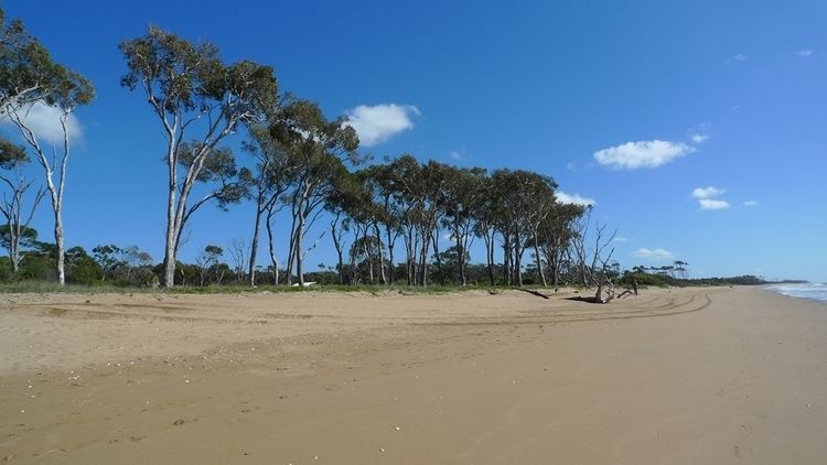
Moore Park boasts almost 20 kilometres (12 mi) of golden sandy beach. The very northern end of the beach is used for four-wheel driving, the southern end is a popular bathing area with seasonal patrols by the Moore Park Surf Lifesaving Club.
The beach is also a nesting site for sea turtles including loggerhead sea turtles in summer months.
Demographics of Moore Park Beach
Moore Park Beach's population has increased from 1,279 in 2001 to 1,599 in 2006 - an increase of 25%.
26 individuals (1.8%) reported aboriginal descent in the 2006 census. 15% of respondents were over 65 years of age. The commonest languages spoken at home were English (96%), German, Maltese, Dutch and Italian.
59.1% of residents reported Christianity as their religion.
Transport
Moore Park is served by a limited bus service operated by Stewart & Sons.