
Elevation 786 m Easiest route Hiking | Prominence 439 m | |
 | ||
Similar Pilot Mountain, Nanny Mountain, Twelve O'clock Knob, Henry's Knob, Crowder's Mountain | ||
Hiking moore s knob at hanging rock state park nc
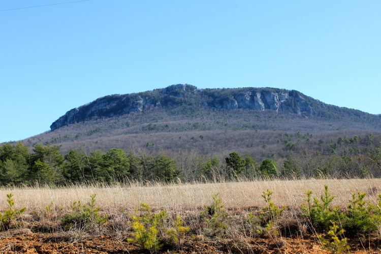
Moore's Knob is the highest mountain in the Sauratown Mountains of Stokes County, North Carolina. The Sauratown Mountains are an isolated remnant of the much larger Blue Ridge Mountains far to the west and north. A rugged, deeply eroded range, the Sauras feature dramatic rock cliffs which can be seen for miles. Moore's Knob has an elevation of 2,579 feet (786 meters) above sea level.
Contents
- Hiking moore s knob at hanging rock state park nc
- Map of Moores Knob Danbury NC 27052 USA
- Moore s knob trail hike
- References
Map of Moore's Knob, Danbury, NC 27052, USA
Moore's Knob sharply rises more than 1,700 feet (520 m) above the surrounding countryside, and it dominates the scenery of Stokes County from almost every direction. The mountain's north side contains Moore's Wall, a huge rock cliff over 400 feet (120 m) in height; the cliff is a favorite destination of rock climbers. The top of the mountain contains an abandoned fire lookout tower; hikers who climb the tower are rewarded with sweeping views of the surrounding countryside and Sauratown mountain range. On a clear day it is possible to see the skyscrapers of Winston-Salem, North Carolina to the south, the uniquely shaped Pilot Mountain some 12 miles (20 km) to the west, and the lofty front ridges of the Blue Ridge Mountains far to the west and north. Moore's Knob is contained within Hanging Rock State Park, and the park maintains a number of hiking and climbing trails on the mountain.