
 | ||
Similar Sugarloaf Mountain, Sandy Spring Friends M, Seneca Creek State Park, Woodend, Clara Barton National | ||
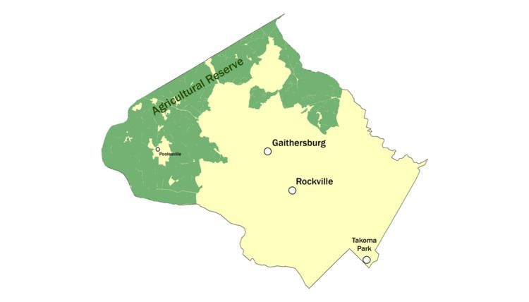
The Agricultural Reserve is a designated land use zone in Montgomery County, Maryland. The 93,000 acres (380 km2) zone was created in 1980 by the Montgomery County Council to preserve farm land and rural space in the northwestern part of the county. The farmland protection program has been characterized as "the most famous, most studied and most emulated" program of its kind in the United States.
Contents
Background
County residents and government planners began to notice the loss of agricultural land and open space as early as the 1950s, associated with the increase in suburbanization following World War II. The general demand for housing in the region was making the farm land increasingly attractive to developers, and the increased property values encouraged many farmers to sell. About one half of the county's farm land was converted to non-farm ownership by the 1960s. The Maryland-National Capital Park and Planning Commission noted a loss of 18,768 acres of farm land over an 8-year period in the 1970s, an average of 2,346 acres/year. Many of the upcounty houses were purchased by people who wanted to live on large areas of land and were willing to drive long distances to down-county areas.
Following studies by a County task force and public discussion, the Council established the Agricultural and Rural Open Space Master Plan in 1980. The overall goals of the agricultural zone are to preserve farms, productive soils, and a way of life. It seeks to preserve farmland through:
Rural density transfer zone and Transferable Development Rights
The 1980 legislation authorized the County government to define a Rural Density Transfer Zone within the Agricultural Reserve, wherein development of new housing is limited to one house per 25 acres (100,000 m2). Previously the allowed density was one house per 5 acres (20,000 m2). The County Council compensated the rural property owners for their loss of developability, through the creation of a legal property right called a Transferable Development Right (TDR). The council assigned one TDR for every five acres of rural land in the designated area. A TDR could be sold to someone who wanted to build elsewhere in the county, at a greater density than would otherwise be allowed in that non-rural zone.
Benefits
According to an advocacy group, the reserve provides the following benefits:
Potential changes
Among the challenges to maintaining the character of the Agricultural Reserve, are several listed by a local advocacy group: The high costs of operating a farm in Montgomery County; increased development of private facilities (e.g. private schools); and development of new highways.