
Quadrant NE Established 1985 Population 10,599 (2006) Local time Friday 8:37 PM | Ward 5 Annexed 1979 Mayor Naheed Nenshi | |
 | ||
Weather 3°C, Wind S at 24 km/h, 57% Humidity | ||
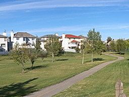
Monterey Park is a residential neighbourhood in the north-east quadrant of Calgary, Alberta. It is located at the eastern edge of the city, and is bounded by McKnight Boulevard to the north, 68 Street E to the west, Trans-Canada Highway to the south and 84 Street E (city limits) to the east.
Contents
Map of Monterey Park, Calgary, AB, Canada
The land was annexed to the city of Calgary between 1979 and 1983, and Monterey Park was established in 1985. It was named for the city of Monterey Park, California, and the neighbourhood has a California theme (such as street names and building styles). It is represented in the Calgary City Council by the Ward 5 councillor.
The postal code in this area is T1Y.
Demographics
In the City of Calgary's 2012 municipal census, Monterey Park had a population of 7004104700000000000♠10,470 living in 7003316400000000000♠3,164 dwellings, a 0.1% increase from its 2011 population of 7004104600000000000♠10,460. With a land area of 3.4 km2 (1.3 sq mi), it had a population density of 3,080/km2 (7,980/sq mi) in 2012.
Residents in this community had a median household income of $64,208 in 2000, and there were 9.9% low income residents living in the neighbourhood. As of 2000, 45.1% of the residents were immigrants. Most buildings were single-family detached homes, and 6.3% of the housing was used for renting.
Education
This neighbourhood has one public elementary school: Monterey Park Elementary School. (K-6)