
Elevation 980 m (3,220 ft) Time zone CET (UTC+1) Patron saint Saint Sebastian | Demonym(s) Montemonachesi Local time Saturday 2:44 AM | |
 | ||
Frazioni Altino, Ariconi, Cerqueto, Cese, Cittadella, Colleregnone, Collina, Ferrà, Foce, Isola San Biagio, Lanciatoio, Le Castagne, Le Vigne, Pescolle, Pignotti, Poggio di pietra, Rascio, Rivo Rosso, Rocca, Rocca da capo, Ropaga, San Giorgio all'Isola, San Lorenzo, Tofe, Vallefiume, Vallegrascia. Weather 11°C, Wind NE at 16 km/h, 40% Humidity | ||
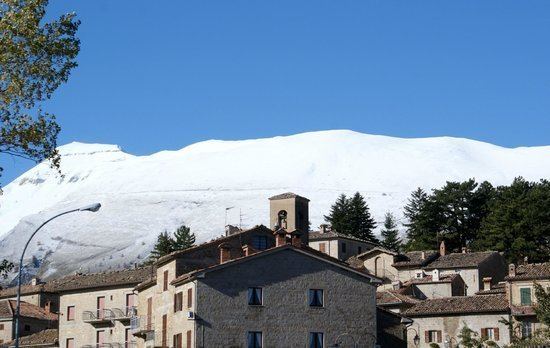
Montemonaco is a town and comune (municipality) in the Province of Ascoli Piceno in the Italian region Marche, located about 90 kilometres (56 mi) south of Ancona and about 20 kilometres (12 mi) northwest of Ascoli Piceno. It is located within the Parco Nazionale dei Monti Sibillini, along the valley of the Aso River, on a plateau facing the Monte Zampa and the Monte Sibilla. In the nearby are also the Monte Vettore and the Lago di Pilato.
Map of 63088 Montemonaco Province of Ascoli Piceno, Italy
Montemonaco borders the following municipalities: Arquata del Tronto, Castelsantangelo sul Nera, Comunanza, Montefortino, Montegallo, Norcia. It takes its name from a Benedictines' monastery founded here around the 8th century.
References
Montemonaco Wikipedia(Text) CC BY-SA