
Demonym(s) Montalbanesi Area 67.4 km² Local time Friday 10:40 PM | Elevation 908 m (2,979 ft) Time zone CET (UTC+1) Postal code 98065 Dialling code 0941 | |
 | ||
Frazioni Pellizzaro, Toscano, Santa Barbara, Villa Braidi, Santa Maria Weather 6°C, Wind W at 11 km/h, 63% Humidity | ||
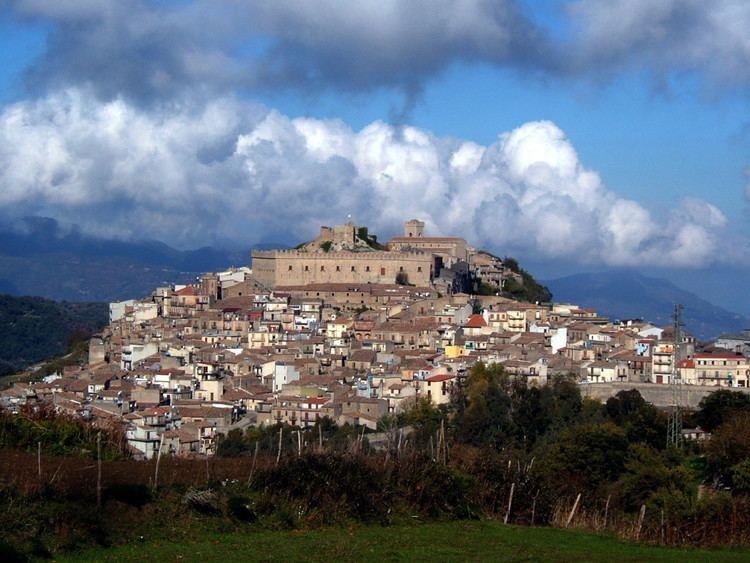
Montalbano Elicona (Sicilian: Muntarbanu) is a comune (municipality) in the Province of Messina in the Italian region Sicily, located about 150 kilometres (93 mi) east of Palermo and about 50 kilometres (31 mi) southwest of Messina on the Nebrodi mountains at the border with the Peloritani range. As of 31 December 2004, it had a population of 2,687 and an area of 67.4 square kilometres (26.0 sq mi).
Map of 98065 Montalbano Elicona Province of Messina, Italy
It is mainly known for the castle built in 1233 by the Emperor Frederic II and the medieval architecture of its streets the megaliths of Argimusco and the natural wood of Malabotta.
The municipality of Montalbano Elicona contains the frazioni (subdivisions, mainly villages and hamlets) Pellizzaro, Toscano, Santa Barbara,Casale, Villa Braidi, and Santa Maria, Santa Venera e Santo Stefano.
Montalbano Elicona borders the following municipalities: Basicò, Falcone, Floresta, Francavilla di Sicilia, Librizzi, Malvagna, Oliveri, Patti, Raccuja, Roccella Valdemone, San Piero Patti, Santa Domenica Vittoria, Tripi.