
Airport type Public Elevation AMSL 2,527 ft / 770 m 3,360 1,024 Code RKC Owner Montague | 14/32 3,360 Phone +1 530-459-3392 | |
 | ||
Address 900 W Old Montague Rd, Montague, CA 96064, USA Similar Siskiyou County Airport, Siskiyou Weights & Measures, Siskiyou County Air Pollution, Siskiyou County Data Proc, Montague City Hall | ||
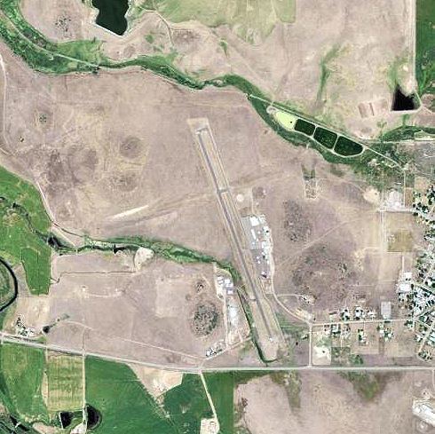
The Montague Airport (IATA: ROF), also known as Yreka Rohrer Field (IATA: ROF, FAA LID: 1O5), is located on the west side of Montague, California. It is owned by the City of Montague.
History
The municipal airport at Montague was created at its present location in 1928. The maintenance hangar and a small weather observatory building were built in 1928. Civilian Conservation Corps funds helped to bring in large quantities of gravel to stabilize the landing area in the early 1930s. Originally the airport was only a north-south dirt strip. A crosswind runway was added in the 1930s. A small amount of paving was added to the south end of the original strip in the 1950s to accommodate drag racing by automobiles, not aircraft.
During World War II, the airport was designated as Montague Air Force Auxiliary Field, and was an auxiliary training airfield for Hamilton Field, California.
The airport returned to civil control in 1945 after the war. The last major improvement consisted of lengthening the runway by six hundred feet to its present 3360 feet in 1982.