
Highest elevation 65 m (213 ft) Population 0 Designated 1975 Area 15 ha | Pop. density 0 /km (0 /sq mi) Elevation 65 m | |
 | ||
Barrio | ||
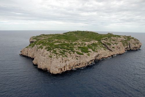
Monito Island (‘Little Mona’) is an uninhabited island about 5 kilometers northwest of the much larger Mona Island. Monito is the masculine diminutive form of Mona in Spanish. It is one of three islands in the Mona Passage, and part of the Isla de Mona e Islote Monito barrio, a subdivision of the municipality of Mayagüez, Puerto Rico. It is inaccessible by sea, barren, reaches 65 metres (213 feet) in height, and measures 0.147 square kilometres (0.06 square miles), or 36.25 acres) in area.
Map of Isla Monito, Mayag%C3%BCez, Puerto Rico
References
Monito Island Wikipedia(Text) CC BY-SA