
County Hamilton FIPS code 39-51212 Area 15.3 km² Population 11,948 (2010) | State Ohio Time zone Eastern (EST) (UTC-5) GNIS feature ID 1065476 Elevation 284 m | |
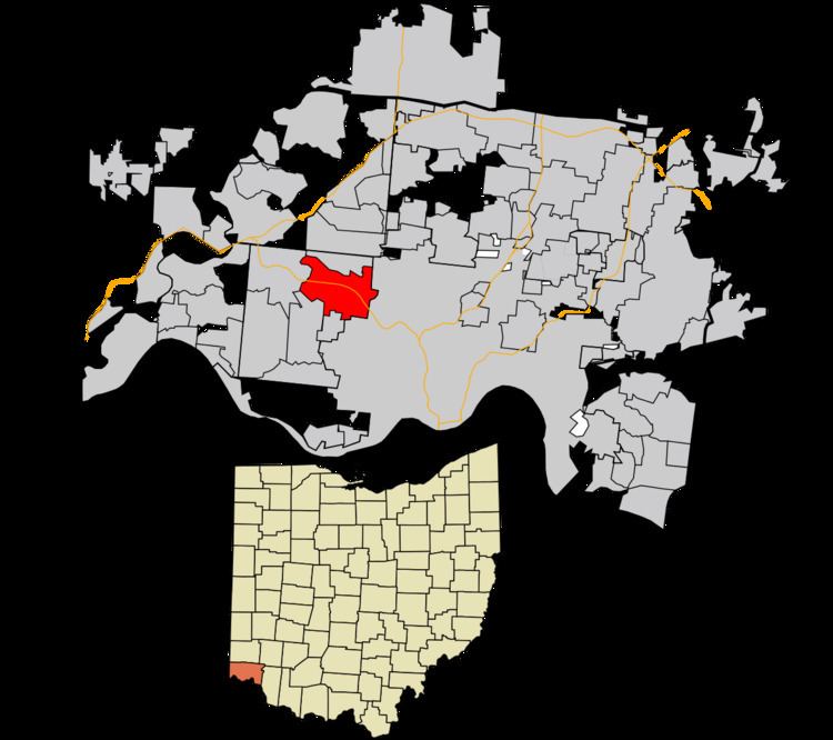 | ||
Monfort Heights is a census-designated place (CDP) in Green Township, Hamilton County, Ohio, United States, part of the Cincinnati–Northern Kentucky metropolitan area. The population of Monfort Heights was 11,948 at the 2010 census. In previous censuses, the area was listed as two separate CDPs, Monfort Heights East and Monfort Heights South.
Contents
Map of Monfort Heights, OH, USA
Geography
Monfort Heights is located at 39°11′17″N 84°36′7″W, 9 miles (14 km) northwest of downtown Cincinnati. The community "runs along North Bend Road with its heart at the intersection of West Fork and North Bend Roads." Just south of this intersection is Exit 14 of Interstate 74 which runs east–west through the CDP.
According to the United States Census Bureau, the CDP has a total area of 5.9 square miles (15.3 km2), all land.
History
The community was earlier known as "Wisenburg" or "Wisenburgh" A post office named "Monfort" was established on March 17, 1900, with Frank Lumler as its first postmaster. The office was named in honor of Civil War Captain E.R. Monfort, who was then the postmaster of Cincinnati. The office was discontinued on September 14, 1905. The name almost disappeared until the late 1920s when a name was needed for a new school district after the consolidation of three area districts and the name "Monfort Heights" was selected.
A 1944 study cited a population of 250 for Monfort Heights in 1920.
Notable person
Monfort Heights is the home of retired music and TV star Bonnie Lou, who was a fixture on Cincinnati radio and television from the 1950s to the 1970s.