
 | ||
East end Loop 12 (Buckner Boulevard) Majorjunctions Skillman StreetGreenville Avenue US 75Hillcrest Road SH 289 (Preston Road) Dallas North TollwayInwood RoadLemmon Avenue Cedar Springs Road to Dallas Love FieldHarry Hines Boulevard I-35E Southwest end SH 356 (Irving Boulevard) | ||
Mockingbird Lane is a road located mainly in central Dallas, Texas. It is one of three main arterial roads in this part of Dallas, and is also a major road through Highland Park.
Contents
Map of Mockingbird Ln, Dallas, TX 75205, USA
Route description
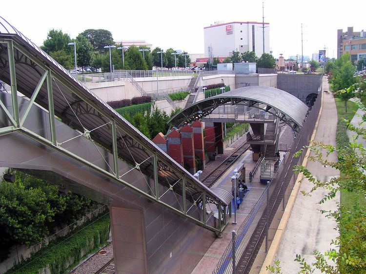
The road runs west from Buckner Boulevard at its eastern terminus, then travels westward past the Mockingbird Station area between Greenville Avenue and North Central Expressway, narrowing to two lanes as it forms the southern boundary of Southern Methodist University, crosses Hillcrest Avenue, and then passes over the Dallas North Tollway, then intersects with Inwood Road. From there, it curves southwestward, intersecting with Cedar Springs Road to give access to the terminal at Dallas Love Field Airport and forming the airport's southeastern boundary, past the University of Texas Southwestern Medical Center while forming the campus's northwestern boundary, has an interchange with Harry Hines Boulevard, curves to the west, and then again to the southwest as it passes under Interstate 35E and Texas State Highway 183. Finally, it intersects Texas State Highway 356 after curving due south, and the street becomes Westmoreland Road at the midpoint of its bridge over the Trinity River floodway into West Dallas. Further east, Mockingbird Lane becomes Peavy Road.
History
After the construction of Mockingbird Station around 2002, developer Ken Hughes invested $600,000 dollars for streetscape improvements for the pedestrians. Unfortunately, the improvements made it worse for the pedestrians and half of the street lights were broken as of September 2012.