
Country Japan District Kamiina Area 54.5 km² Local time Wednesday 8:27 AM | Region Chūbu (Kōshin'etsu) Phone number 0265-85-3181 Population 8,831 (Oct 2016) Prefecture Nagano Prefecture | |
 | ||
Time zone Japan Standard Time (UTC+9) Address 98 banchi, Miyada-mura, Kamiina-gun, Nagano-ken 399-4301 Weather 4°C, Wind NW at 11 km/h, 61% Humidity | ||
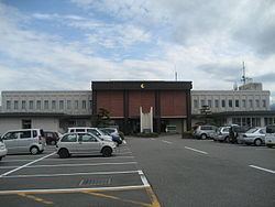
Miyada (宮田村, Miyada-mura) is a village located in Kamiina District in south-central Nagano Prefecture, in the Chūbu region of Japan. As of 1 October 2016, the village had an estimated population of 8,831 and a population density of 162 persons per km². Its total area was 54.50 square kilometres (21.04 sq mi).
Contents
- Map of Miyada Kamiina District Nagano Prefecture Japan
- Geography
- Surrounding municipalities
- History
- Railway
- Highway
- References
Map of Miyada, Kamiina District, Nagano Prefecture, Japan
Geography
Miyada is located in the Kiso Mountains of central Nagano Prefecture, with Mount Kisokoma (2956 meters) within the village limits. The Tenryū River flows through the village. The Koshibu Dam is located in Nakagawa.
Surrounding municipalities
History
The area of present-day Miyada was part of ancient Shinano Province. The village was founded on September 30, 1956 by separating from the city of Komagane.
Railway
Highway
References
Miyada, Nagano Wikipedia(Text) CC BY-SA