
Surface area 3,180 acres (1,290 ha) | Area 12.87 km² | |
 | ||
Etymology Miami Language for "water on a slope". Similar Salamonie Lake Dam, Miami State Recreatio, Grissom Air Museum, Circus Hall of Fame, Starve Hollow State Rec | ||
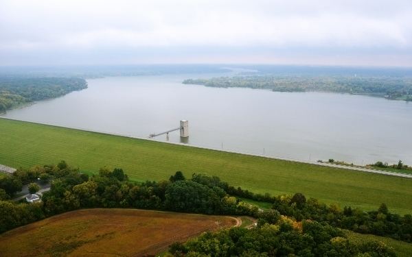
Mississinewa Lake Dam is a dam in Miami County, Indiana, just outside the town of Peru, in the central part of the state.
Map of Mississinewa Lake Dam, Peru, IN 46970, USA
The earthen dam was constructed from 1962 to 1967 by the United States Army Corps of Engineers, with a height of 140 feet, and 8000 feet long at its crest. It impounds the Mississinewa River for irrigation storage and flood control. The dam is owned and operated by the Great Lakes and Ohio River Division of the Corps of Engineers.
The reservoir it creates, Mississinewa Lake, has a normal water surface of five square miles, has a maximum capacity of 368,400 acre-feet, and a normal capacity of 75,200 acre-feet. Recreation includes fishing, boating, and swimming. Nearby recreation areas include the Miami State Recreation Area, the Red Bridge State Recreation Area, the Pearson Mill State Recreation Area, and the Frances Slocum State Recreation Area.