
Local time Tuesday 5:52 AM Number of airports 1 | Province Saskatchewan | |
 | ||
Weather -13°C, Wind S at 11 km/h, 79% Humidity | ||
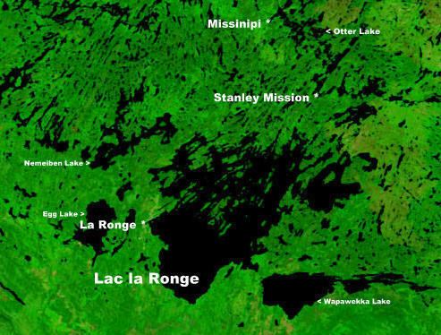
Missinipe is a northern settlement in north-central Saskatchewan, Canada. It is located 80 km (50 mi) north of La Ronge on the western shore of Otter Lake. It has a float plane service, canoe outfitter, and fishing outfitters. It is a main access point to the Churchill River. The next settlement north is Brabant Lake, Saskatchewan, 88 km north, then Southend, 142 km north at the south end of Reindeer Lake. The community of Grandmother's Bay, an extension of the Lac La Ronge First Nation, lies approximately 5 miles to the northeast, directly across Otter Lake. There are provincial campgrounds 5 km north at Otter Rapids, 7 km north at the Devil Lake Provincial Recreation Site, and 1.5 km south. There is also a provincial campground within the community itself. The community of Missinipe is within Lac La Ronge Provincial Park, at its northern tip. The community contains a seasonally operated general store, tourist cabins and other accommodations. Tourism and facilitation of wilderness travel are its main focus. The community may be accessed by Highway 102, or by float plane.
Map of Missinipe, SK, Canada
Missinipe had 39 residents in 2011 up from 5 residents in 2006.
Missinipe is the Woodland Cree word meaning "big water".