
Width 935 m (3,068 ft) Highest elevation 59 m (194 ft) Area 116 ha | Length 2.1 km (1.3 mi) Coastline 4.9 km (3.04 mi) Highest point Storhaugen | |
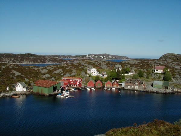 | ||
Misje is an island (and village) in Fjell municipality in Hordaland county, Norway. The 1.16-square-kilometre (0.45 sq mi) island lies just south of the island of Toftøyna and north of the large island of Sotra. Almost all of the 257 inhabitants (as of 2009) live on the eastern part of the island, which is referred to as the village of Misje.
Map of Misje, 5366 Misje, Norway
Historically, the island was part of the old municipality of Herdla. In 1964, it was transferred to the newly established municipality of Fjell. The island has been connected to the neighboring island of Sotra by the Solviksundet Bridge since 1982. Sotra, in turn, is connected to the mainland by a series of bridges.
References
Misje Wikipedia(Text) CC BY-SA