
District Senboku - Flower Lavender Population 20,101 (May 2015) | - Tree Japanese red pine Area 168.3 km² Local time Tuesday 1:01 PM | |
 | ||
Weather 4°C, Wind E at 11 km/h, 85% Humidity Points of interest Lavender misato, Senhata Hot Spring, Mt Mahiru | ||
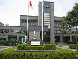
Misato (美郷町, Misato-chō) is a town located in Senboku District, Akita, in the northern Tohoku region of Japan. As of May 2015, the town had an estimated population of 20,101 and a population density of 119 persons per km². The total area was 168.34 km².
Contents
- Map of Misato Senboku District Akita Prefecture Japan
- Geography
- Neighboring municipalities
- Climate
- History
- Economy
- Railway
- Highway
- Sister city relations
- Noted people from Misato
- References
Map of Misato, Senboku District, Akita Prefecture, Japan
Geography
Misato is located at the far southeastern of Akita Prefecture, bordered by the Ou Mountains and Iwate Prefectures to the east.
Neighboring municipalities
Climate
Misato has a Humid continental climate (Köppen climate classification Cfa) with large seasonal temperature differences, with warm to hot (and often humid) summers and cold (sometimes severely cold) winters. Precipitation is significant throughout the year, but is heaviest from August to October.
History
The area of present-day Misato was part of ancient Dewa Province, dominated by the Satake clan during the Edo period, who ruled Kubota Domain under the Tokugawa shogunate. The modern town of Misato was established on November 1, 2004 from the merger of the towns of Senhata and Rokugō with the village of Sennan.
Economy
The economy of Misato is based on agriculture and forestry.