
 | ||
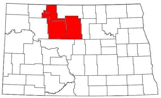
The Minot Micropolitan Statistical Area, as defined by the United States Census Bureau, is an area consisting of three counties in North Dakota, anchored by the city of Minot. As of the 2010 census, the μSA had a population of 69,540. In 2012, it was estimated that the population of the Minot Micropolitan Area was 73,146
Contents
Counties
Places with more than 30,000 inhabitants
Places with 1,000 to 10,000 inhabitants
Places with less than 100 inhabitants
Unincorporated places
Demographics
As of the census of 2000, there were 67,392 people, 26,652 households, and 17,815 families residing within the μSA. The racial makeup of the μSA was 93.17% White, 1.95% African American, 1.86% Native American, 0.74% Asian, 0.05% Pacific Islander, 0.64% from other races, and 1.58% from two or more races. Hispanic or Latino of any race were 1.73% of the population.
The median income for a household in the μSA was $30,563, and the median income for a family was $37,680. Males had a median income of $26,335 versus $18,345 for females. The per capita income for the μSA was $16,181.