
Country United States County Hennepin Incorporated 1956 Area 73.09 km² Area code 952 | State Minnesota Founded 1850s Elevation 889 ft (271 m) Local time Monday 9:24 AM Population 51,368 (2013) | |
 | ||
Weather -9°C, Wind NE at 18 km/h, 74% Humidity | ||
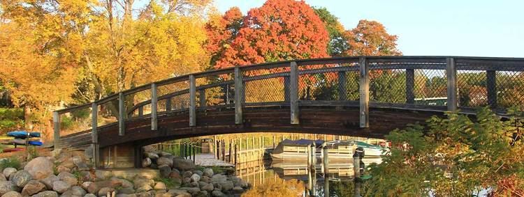
Ridgegate apartments minnetonka minnesota
Minnetonka /ˌmɪnᵻˈtɒŋkə/ MIN-i-TONG-kə is a suburban city in Hennepin County, Minnesota, United States, eight miles (13 km) west of Minneapolis. The population was 49,734 at the 2010 census. The name comes from the Dakota Indian mni tanka, meaning "great water". The city is the home of Cargill, the country's largest privately owned company, and United Healthcare, the state's largest publicly owned company.
Contents
- Ridgegate apartments minnetonka minnesota
- Map of Minnetonka MN USA
- Geography
- Economy
- Top employers
- History
- Public schools
- Private schools
- Public libraries
- 2010 census
- 2000 census
- Government
- Politics
- Notable people
- References
Map of Minnetonka, MN, USA
Geography
According to the United States Census Bureau, the city has a total area of 28.22 square miles (73.09 km2), of which 26.93 square miles (69.75 km2) is land and 1.29 square miles (3.34 km2) is water. Part of the city includes the eastern tip of Lake Minnetonka, one of the largest lakes in Minnesota. The outlet of Lake Minnetonka is Minnehaha Creek, which winds through south Minneapolis and flows over Minnehaha Falls and into the Mississippi River. Minnetonka is located 8 miles (13 km) west of Minneapolis, in Hennepin County.
Economy
The headquarters of Carlson Companies are in Minnetonka. The headquarters of Cargill are located in Minnetonka and are in the Wayzata Post Office area. Founded in 1865, it is now the largest privately held corporation in the U.S. in terms of revenue. Other companies based in Minnetonka include the uniform companies AmeriPride Services and G&K Services.
Top employers
According to the city's 2011 Comprehensive Annual Financial Report, the top employers in the city are:
History
Since the mid-19th century, Minnetonka has evolved from heavily wooded wilderness through extensive farming and thriving industrialization to its present primarily residential suburban character. The Dakota and Ojibwe Indians were the first people to settle in the area. They believed the land around Lake Minnetonka (minne meaning water and tonka meaning big) was the legendary home of an extinct race. The first recorded exploration of the area by European settlers was in 1822, when a group from newly constructed Fort Snelling made its way up Minnehaha Creek (then known as Brown's Creek or Falls Creek) to the lake. In 1851, the Dakota sold the area including Minnetonka to the United States with the Treaty of Traverse des Sioux. The first census, the Territorial Census of 1857, lists 41 households. Twenty-nine of the heads of households are listed as farmers. The occupations of the remaining twelve are associated with the operations of Minnetonka Mill and a nearby hotel.
In 1852, a claim was staked on Minnehaha Creek near McGinty Road. The sawmill that was constructed in the thick woods of maple, oak, elm, red cedar and basswood was the first privately operated mill in Minnesota west of the Mississippi River. Oak timbers from this mill were used to build the first suspension bridge across the Mississippi River at Saint Anthony Falls in 1853. The settlement of Minnetonka Mills that grew up around the mill was the first permanent European–American settlement west of Minneapolis in Hennepin County. In 1855, a two-story sawmill was constructed with a furniture factory on the second floor. A building for varnishing furniture was built on the south side of the creek, at the present Bridge Street. Production consisted mainly of chairs and bedsteads. The Minnetonka Republican at St. Anthony published a short article describing the area. The February 12, 1857, issue said:
In 1860, after only 8 years of operation, the sawmill closed. In 1869, a flour and grist mill were constructed and operated until the late 1880s. In 1874, Charles H. Burwell came to manage the Minnetonka Mill Company, and he built a Victorian home on the north bank of Minnehaha Creek (Minnetonka Boulevard at McGinty Road East) for his family. The Charles H. Burwell House is now on the National Register of Historic Places and is owned by the city. There were two other mills in Minnetonka. The St. Alban's Mill, which was less than 1 mile (2 km) downstream from Minnetonka Mills on Minnehaha Creek, operated as a flour mill from 1874 to 1881. A grist mill built on Purgatory Creek was washed out in a flood shortly after construction. Minnetonka Mills, with its post office and port for Lake Minnetonka, was the principal business and trading center for a large area until the 1870s.
Between 1883 and 1956, the area within the original 36-square-mile (93 km2) township grew smaller as Wayzata, Hopkins, Deephaven, Woodland and Saint Louis Park incorporated or annexed portions of then-Minnetonka Township. Excellent transportation facilities to Hopkins and Minneapolis began to transform the township's economy. Train service to Minneapolis had been available since the 1880s, and in 1905 streetcar service began. The attraction to become a city wage earner was great and rapid transit made it possible. In 1956, as a maneuver to prevent neighboring villages from continuing to annex portions of then-Minnetonka Township, residents in 1956 voted to establish a village out of the remaining 28 square miles (73 km2), and the area was incorporated as Minnetonka Village. However, Minnetonka Village lasted only thirteen years. The complexities and the heavy demands of administering a rapidly developing community required professional management and larger representation. In 1969, a city charter was approved to serve the 35,000 residents. Ridgedale Center is located in Minnetonka.
Public schools
The city of Minnetonka is covered by three independent school districts. The Hopkins School District, which encompasses the central and eastern part of Minnetonka; the Minnetonka School District, in the western part of city north of Lake Minnetonka; and the Wayzata School District, which covers an area along the southern boundary of the city. Some students attend public schools in other school districts chosen by their families under Minnesota's open enrollment statute.
The Minnetonka School District also includes four schools outside of the city of Minnetonka: Deephaven Elementary School (Deephaven, MN),Excelsior Elementary School (Excelsior, MN), Minnewashta Elementary School (Shorewood, MN), and Minnetonka Middle School West (Chanhassen, MN)
The Hopkins School District comprises two thirds of the city of Minnetonka, the entirety of Hopkins, and portions of the cities of Golden Valley, Edina, St. Louis Park, Wayzata, and Plymouth. In addition to schools located within Minnetonka, the Hopkins School District also includes four schools in the cities of Hopkins and Golden Valley: Eisenhower Elementary School/Xin Xing Academy (Hopkins, MN), Alice Smith Elementary School (Hopkins, MN), Meadowbrook Elementary School (Golden Valley, MN), and Harley Hopkins Early Childhood/Family Center (Hopkins, MN).
Private schools
There are three private and parochial schools within Minnetonka's city limits:
Public libraries
The Hennepin County Library has its headquarters in the Ridgedale Library in Minnetonka. In addition the system operates the Minnetonka Library.
2010 census
As of the census of 2010, there were 49,734 people, 21,901 households, and 13,619 families residing in the city. The population density was 1,846.8 inhabitants per square mile (713.1/km2). There were 23,294 housing units at an average density of 865.0 per square mile (334.0/km2). The racial makeup of the city was 90.0% White, 3.7% African American, 0.3% Native American, 3.1% Asian, 0.7% from other races, and 2.1% from two or more races. Hispanic or Latino of any race were 2.4% of the population.
There were 21,901 households of which 25.9% had children under the age of 18 living with them, 52.1% were married couples living together, 7.3% had a female householder with no husband present, 2.8% had a male householder with no wife present, and 37.8% were non-families. 31.1% of all households were made up of individuals and 11.9% had someone living alone who was 65 years of age or older. The average household size was 2.25 and the average family size was 2.85.
The median age in the city was 45 years. 20.8% of residents were under the age of 18; 6% were between the ages of 18 and 24; 23.2% were from 25 to 44; 33.3% were from 45 to 64; and 16.7% were 65 years of age or older. The gender makeup of the city was 47.5% male and 52.5% female.
2000 census
As of the census of 2000, there were 51,301 people, 21,393 households, and 14,097 families residing in the city. The population density was 1,893.0 persons per square mile (729.7/km²). There were 22,228 housing units at an average density of 818.9 per square mile (316.2/km²). The racial makeup of the city was 94.40% White, 1.50% African American, 0.20% Native American, 2.29% Asian, 0.03% Pacific Islander, 0.57% from other races, and 1.03% from two or more races. Hispanic or Latino of any race were 1.28% of the population. 24.7% were of German, 13.8% Norwegian, 9.1% Irish, 8.2% Swedish and 6.7% English ancestry.
There were 21,393 households out of which 29.1% had children under the age of 18 living with them, 56.6% were married couples living together, 6.8% had a female householder with no husband present, and 34.1% were non-families. 27.3% of all households are made up of single individuals and 9.3% had someone living alone who was 65 years of age or older. The average household size was 2.37 and the average family size was 2.92.
In the city, the population was spread out with 23.1% under the age of 18, 6.0% from 18 to 24, 28.5% from 25 to 44, 28.4% from 45 to 64, and 14.0% who were 65 years of age or older. The median age was 41 years. For every 100 females there were 91.8 males. For every 100 females age 18 and over, there were 88.7 males.
According to the 2000 US Census, the median income for a household in the city was $83,437.
Government
The City Council of Minnetonka consists of the mayor and six council members. Of the six council members, two are elected at large and the remaining four are elected from wards. The council exercises the legislative power of the city and determines all matters of policy. It has the responsibility of basic decisions for the community, including appointment of the city manager. The city manager is responsible for putting council policies into effect and administering affairs of city government.
The United States Postal Service operates the Minnetonka Post Office and the Minnetonka Carrier Annex. In addition, Minnetonka is served by four zip codes: one representing Minnetonka (55345), two representing Hopkins, MN (55305, 55343) and one representing Wayzata, MN (55391).
Politics
Minnetonka is located in Minnesota's 3rd congressional district, represented by Republican Erik Paulsen.