
Area code(s) 608 Elevation 271 m Local time Wednesday 7:38 PM | Time zone Central (CST) (UTC-6) FIPS code 55-52200 Population 5,564 (2013) | |
 | ||
Weather 1°C, Wind E at 16 km/h, 50% Humidity | ||
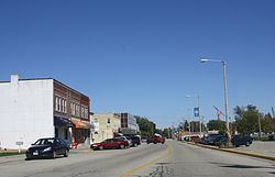
Milton is a city in Rock County, Wisconsin, United States. The population was 5,546 at the 2010 census.
Contents
Map of Milton, WI 53563, USA
History
The city was formed as a result of the 1967 merger of the villages of Milton and Milton Junction. In November of that year, ballots were cast by 1,093 voters from both villages (Milton: 515 to 47 in favor of the merge; Milton Junction: 322 to 201 in favor of the merge), and the referendum to merge the two was approved by 77%.
Originally named Prairie du Lac, Milton was settled in 1838 by Joseph Goodrich, who built an inn, the Milton House, at the intersection of two trade routes. The Milton House is today one of the oldest poured grout structures in the United States. A noted abolitionist, Goodrich is known to have aided fugitive slaves escape to freedom via the Underground Railroad.
It is believed that Milton is named after poet John Milton, author of "Paradise Lost", after a settler remarked that the town was his "Paradise Regained" after leaving his previous home, which he thought of as a paradise lost.
Geography
Milton is located at 42°46′40″N 88°57′18″W (42.777795, -88.955133).
According to the United States Census Bureau, the city has a total area of 3.54 square miles (9.17 km2), of which, 3.53 square miles (9.14 km2) is land and 0.01 square miles (0.03 km2) is water.
2010 census
As of the census of 2010, there were 5,546 people, 2,231 households, and 1,499 families residing in the city. The population density was 1,571.1 inhabitants per square mile (606.6/km2). There were 2,382 housing units at an average density of 674.8 per square mile (260.5/km2). The racial makeup of the city was 96.0% White, 0.5% African American, 0.2% Native American, 1.0% Asian, 1.1% from other races, and 1.1% from two or more races. Hispanic or Latino of any race were 2.4% of the population.
There were 2,231 households of which 35.8% had children under the age of 18 living with them, 49.4% were married couples living together, 11.9% had a female householder with no husband present, 5.9% had a male householder with no wife present, and 32.8% were non-families. 26.8% of all households were made up of individuals and 11% had someone living alone who was 65 years of age or older. The average household size was 2.48 and the average family size was 2.98.
The median age in the city was 35.8 years. 26.3% of residents were under the age of 18; 7.8% were between the ages of 18 and 24; 28.3% were from 25 to 44; 25.1% were from 45 to 64; and 12.5% were 65 years of age or older. The gender makeup of the city was 49.1% male and 50.9% female.
2000 census
As of the census of 2000, there were 5,132 people, 2,034 households, and 1,383 families residing in the city. The population density was 1,587.8 people per square mile (613.5/km²). There were 2,129 housing units at an average density of 658.7 per square mile (254.5/km²). The racial makeup of the city was 98.07% White, 0.18% Black or African American, 0.14% Native American, 0.31% Asian, 0.49% from other races, and 0.82% from two or more races. 0.92% of the population were Hispanic or Latino of any race.
There were 2,034 households out of which 36.6% had children under the age of 18 living with them, 52.9% were married couples living together, 11.2% had a female householder with no husband present, and 32.0% were non-families. 26.5% of all households were made up of individuals and 10.8% had someone living alone who was 65 years of age or older. The average household size was 2.51 and the average family size was 3.04.
In the city, the population was spread out with 27.6% under the age of 18, 8.6% from 18 to 24, 31.7% from 25 to 44, 20.3% from 45 to 64, and 11.9% who were 65 years of age or older. The median age was 34 years. For every 100 females there were 96.2 males. For every 100 females age 18 and over, there were 90.6 males.
The median income for a household in the city was $43,201, and the median income for a family was $52,384. Males had a median income of $39,392 versus $22,866 for females. The per capita income for the city was $22,058. About 3.3% of families and 6.7% of the population were below the poverty line, including 7.1% of those under age 18 and 13.4% of those age 65 or over.
Economy
Milton is the site of a $70 million ethanol plant built by United Cooperative. A Cargill animal nutrition plant is located in Milton, with a 170-foot (52 m) grain elevator.
Education
Milton Schools include Milton High School, Milton Middle School, Northside Intermediate School, Milton East Elementary, Milton West Elementary, Consolidated Elementary, Harmony School, and Blackhawk Tech which was MECAS (Milton Edgerton Clinton Alternative School).
The former Milton College operated from 1844 to 1982. Milton native, Albert Whitford, a graduate of the college, became a leading astronomer. Another alumnus, Dave Krieg, was an All-Pro quarterback with the Seattle Seahawks.
The city is increasingly tied to Janesville, its larger neighbor to the south, and parts of Janesville are now within the Milton School District as that city expands to the north and east. Students that go to Milton may live in several other districts surrounding Milton such as Janesville and Harmony district.