
Population 2,013 (2011 census) Location 3 km (2 mi) from CBD Milsons Point Kirribilli Postal code 2061 Lga North Sydney Council | Postcode(s) 2061 State electorate(s) North Shore Area 20 ha Local time Thursday 10:31 AM Federal division Division of North Sydney | |
 | ||
Weather 22°C, Wind S at 19 km/h, 71% Humidity | ||
Milsons Point is a suburb on the lower North Shore of Sydney, in the state of New South Wales, Australia. The suburb is located 3 kilometres north of the Sydney central business district in the local government area of North Sydney Council.
Contents
- Map of Milsons Point NSW 2061 Australia
- History
- Transport
- Commercial area
- Notable Residents
- Sport and recreation
- Schools
- Churches
- References
Map of Milsons Point NSW 2061, Australia
Milsons Point is also the geographical feature that juts into Sydney Harbour from the northern side, directly opposite Sydney Cove, the spot where the first European settlement was established in 1788.
Milsons Point was named after James Milson (1783–1872), one of the earliest settlers.
History
Milsons Point was named after James Milson (1783–1872), a free settler originally from Lincolnshire.
Milson settled in the area near Milsons Point and established a profitable business supplying ships with stone ballast, fresh water, and the produce of his dairy, orchard, and vegetable gardens.
The last of the family's holdings in the lower North Shore area were resumed in the early 1920s for the construction of the Harbour Bridge and associated roadways.
Transport
Milsons Point supports the northern end of the Sydney Harbour Bridge. Milsons Point is well connected with the CBD of Sydney by the bridge, ferries and trains. The Warringah Freeway provides a link south to the Sydney CBD and north to Chatswood.
Milsons Point railway station is on the northern approach to the Sydney Harbour Bridge. The Milsons Point ferry wharf, serviced by the Balmain, Pyrmont Bay and Rydalmere ferry lines, is located to the west of the bridge in the south-west part of the suburb. In addition to rail services, Milson's Point is serviced by buses that run to the Lower North Shore and Northern Beaches. School Buses leave from Bradfield Park to transport students to schools in North Sydney.
Commercial area
Milsons Point has a mixture of residential and commercial development.
Notable Residents
Sport and recreation
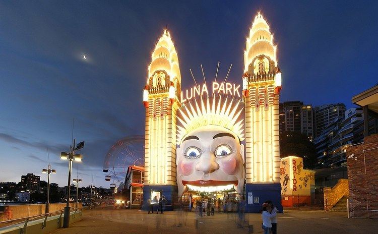
Milsons Point has the entertainment centre Luna Park and the North Sydney Olympic Pool.
Schools
Schools in the area include the Catholic schools Loreto Kirribilli for girls and St Aloysius' College for boys.