
Local time Wednesday 12:25 PM | ||
 | ||
Weather 29°C, Wind W at 13 km/h, 60% Humidity | ||
Miloli'i is an unincorporated community on the island of Hawaii in the U.S. state of Hawaii, 33 miles south of Kailua-Kona. The village is situated at the seacoast where the 1926 lava flow from Mauna Loa entered the ocean.
Map of Milolii, HI 96704, USA
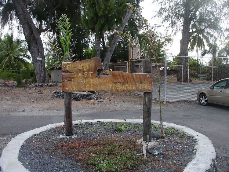
Miloli'i is purported to be "the last Hawaiian fishing village" according to a wooden sign in their community center. Without access to power lines or water, each house provides its own electricity and water with solar panels and tanks that collect rain water.
On February 5, 1868 a tsunami carried a church, named Hau'oli Kamana'o and swept it away to Miloli'i. Surprisingly, the church remained in good condition and still stands in Miloli'i today.
References
Milolii, Hawaii Wikipedia(Text) CC BY-SA