
Type Natural, oligotrophic Basin countries United States Area 229 ha Surface elevation 1,717 m Shore length 6.9 km | Surface area 566 acres (229 ha) Max depth 44 m Mean depth 24 m Outflow location Miller Creek | |
 | ||
Primary inflows Catchment area 11 square miles (28 km) | ||
Miller Lake is a large natural freshwater lake in the Cascade Range in western Klamath County in the U.S. state of Oregon. The lake is in the Winema National Forest, about 14 miles (23 km) west of Chemult via Miller Lake Road (Forest Road 9772).
Map of Miller Lake, Oregon 97733, USA
Recreation at the lake includes fishing for stocked rainbow and brown trout and kokanee. The lake has been called "one of the best brown trout fisheries in the state". Many brown trout in the lake, which is open for night fishing as well as day fishing, exceed 26 inches (66 cm) in length.
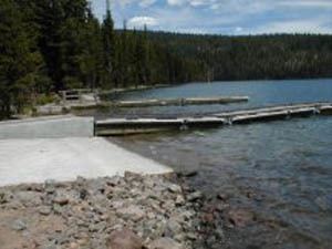
Miller Lake is also used for swimming and non-motorized boating. Hiking trails in the vicinity provide access to the Mount Thielsen Wilderness and the Pacific Crest Trail. Digit Point Campground at the lake has 64 individual camping sites with access to picnic tables, potable water, and toilets. Mosquito infestations may require repellant or headnets.