
Local time Wednesday 9:36 AM | Area code(s) 250, 778 | |
 | ||
Weather 9°C, Wind S at 11 km/h, 89% Humidity | ||
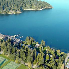
Mill Bay is a commuter town of about 3,200 people located on Vancouver Island, British Columbia, Canada about 30 km (19 mi) north of Victoria, the capital.
Contents
Map of Mill Bay, BC, Canada
Mill Bay was founded in the 1860s with lumber and milling as its primary industries, done at the mill on the bay. It is known for its ferry to Brentwood Bay on the Saanich Peninsula and the historic Malahat Drive, which is also a source of criticism due to frequent closures from either automobile accidents or weather conditions. Numerous suggestions have been made by various groups regarding a 'bypass' route (possibly a bridge), though as of 2007, the Brentwood-Mill Bay Ferry and the Malahat remain the best routes to Greater Victoria from the rest of Vancouver Island (a third route goes south from Lake Cowichan via Port Renfrew to Victoria). The MV Mill Bay that has served the ferry route since 1956 is named for the town.
Mill Bay schools
Brentwood College is a private high school located in Mill Bay. Frances Kelsey Secondary School is a local public high school named after pharmacologist Frances Oldham Kelsey.
Neighbouring communities
The village of Shawnigan Lake is a ten-minute drive from Mill Bay. Cobble Hill, Cowichan Bay, and Duncan are also part of the Cowichan Valley.
Community organizations
The Mill Bay Freemasons Hall meets on the third Thursday of the month and also offers room to other community organizations.