
Country United States County Dale FIPS code 01-48400 Elevation 115 m Zip code 36350 Local time Tuesday 12:37 PM | Time zone Central (CST) (UTC-6) GNIS feature ID 0152313 Area 15.7 km² Population 2,380 (2013) Area code 334 | |
 | ||
Weather 27°C, Wind W at 11 km/h, 54% Humidity | ||
Midland City is a town in Dale County, Alabama, United States. At the 2010 U.S. Census the population was 2,344. It incorporated in 1890. It is part of the Ozark Micropolitan Statistical Area.
Contents
- Map of Midland City AL 36350 USA
- 2013 hostage standoff
- Geography
- Demographics
- 2010 census
- Notable people
- References
Map of Midland City, AL 36350, USA
2013 hostage standoff
On January 29, 2013, 65-year-old Vietnam War-era veteran Jimmy Lee Dykes climbed aboard a school bus and fatally shot the driver; he then abducted at random a five-year-old boy named Ethan, who was sitting at the closest seat. He took Ethan into an underground bunker, where he held him captive. About a week after the incident, FBI agents were able to storm the bunker, kill Dykes, and rescue Ethan.
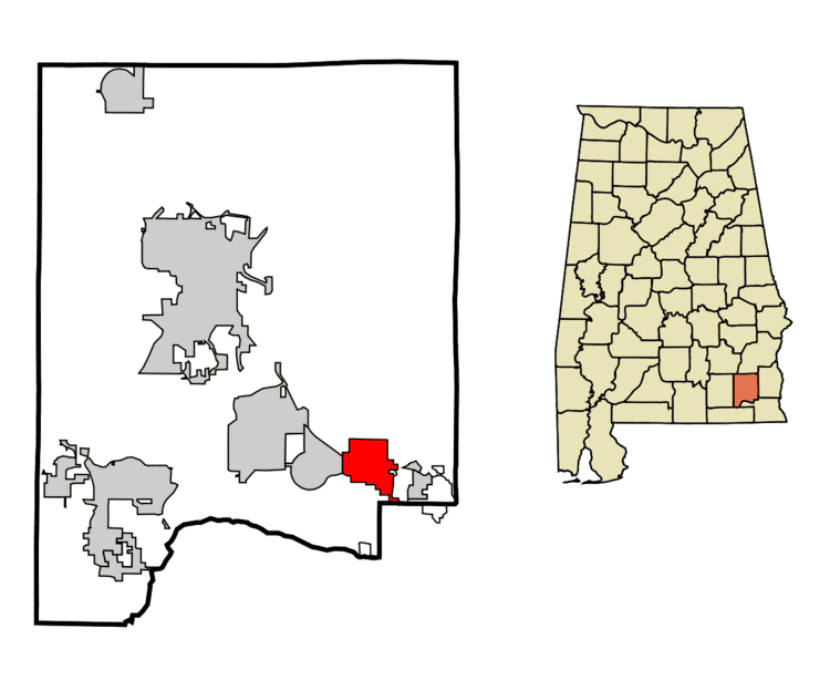
Geography
Midland City is located in southeastern Dale County at 31°18′29″N 85°29′26″W (31.307945, -85.490606). It is bordered to the east by the town of Napier Field, to the southeast by the city of Dothan, and to the west by the town of Pinckard. U.S. Route 231 passes through the town, leading northwest 13 miles (21 km) to Ozark, the Dale County seat, and southeast 9 miles (14 km) to the center of Dothan. Alabama State Route 134 passes through the center of Midland City, leading east 10 miles (16 km) to Headland and west 7 miles (11 km) to Newton via Pinckard.
According to the U.S. Census Bureau, Midland City has a total area of 6.1 square miles (15.7 km2), all land.
Demographics
As of the census of 2000, there were 1,703 people, 707 households, and 477 families residing in the town. The population density was 282.1 people per square mile (108.9/km²). There were 805 housing units at an average density of 133.3 per square mile (51.5/km²). The racial makeup of the town was 70.58% White, 25.19% Black or African American, 0.70% Native American, 0.35% Asian, 0.12% from other races, and 3.05% from two or more races. 0.76% of the population were Hispanic or Latino of any race.
There were 707 households out of which 34.5% had children under the age of 18 living with them, 40.7% were married couples living together, 21.4% had a female householder with no husband present, and 32.5% were non-families. 28.7% of all households were made up of individuals and 10.5% had someone living alone who was 65 years of age or older. The average household size was 2.41 and the average family size was 2.93.
In the town, the population was spread out with 29.7% under the age of 18, 8.6% from 18 to 24, 27.2% from 25 to 44, 21.6% from 45 to 64, and 12.9% who were 65 years of age or older. The median age was 34 years. For every 100 females there were 89.2 males. For every 100 females age 18 and over, there were 82.3 males.
The median income for a household in the town was $20,000, and the median income for a family was $24,474. Males had a median income of $26,927 versus $17,174 for females. The per capita income for the town was $11,438. About 26.0% of families and 30.8% of the population were below the poverty line, including 44.1% of those under age 18 and 22.2% of those age 65 or over.
2010 census
As of the census of 2010, there were 2,344 people, 944 households, and 636 families residing in the town. The population density was 392 people per square mile (150.8/km²). There were 1,014 housing units at an average density of 169 per square mile (65/km²). The racial makeup of the town was 70.4% White, 23.3% Black or African American, 0.5% Native American, 0.4% Asian, 1.7% from other races, and 3.7% from two or more races. 4.1% of the population were Hispanic or Latino of any race.
There were 944 households out of which 32.9% had children under the age of 18 living with them, 37.6% were married couples living together, 22.4% had a female householder with no husband present, and 32.6% were non-families. 26.9% of all households were made up of individuals and 7.5% had someone living alone who was 65 years of age or older. The average household size was 2.48 and the average family size was 2.98.
In the town, the population was spread out with 28.0% under the age of 18, 10.8% from 18 to 24, 28.4% from 25 to 44, 22.4% from 45 to 64, and 10.5% who were 65 years of age or older. The median age was 31.6 years. For every 100 females there were 90.4 males. For every 100 females age 18 and over, there were 88.4 males.
The median income for a household in the town was $29,591, and the median income for a family was $39,071. Males had a median income of $33,305 versus $23,897 for females. The per capita income for the town was $16,283. About 26.7% of families and 27.0% of the population were below the poverty line, including 36.9% of those under age 18 and 11.0% of those age 65 or over.
Notable people
In August 2016, Interim Mayor, Patsy Capshaw Skipper garnered national attention due to a racist Facebook comment. When asked about the election by a Facebook friend, Patsy Capshaw Skipper replied, "I lost. The nigger won", referring to her opponent Joann Grimsley who was elected as Midland City's first black mayor.