
Topo map USGS Rockford Bay Prominence 811 m Parent range Selkirk Mountains | Elevation 1,597 m Mountain range Selkirk Mountains | |
 | ||
Location Kootenai County, Idaho, U.S. Similar Mount Harrison, Mount Sir Sandford, Mount Spokane, Bald Mountain | ||
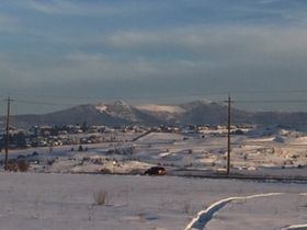
Mica Peak is a mountain summit in Kootenai County in the state of Idaho, United States. Mica Peak climbs to 5,243 feet (1,598 m) above sea level in the Selkirk Mountain range. State Line, Idaho is the closest city at 6.9 miles away.
Map of Mica Peak, Idaho 83854, USA
This summit was once commonly known as "Signal Point" and the name "Mica Peak" is considered erroneous, as there is a Mica Peak in Washington State just across the border. There was briefly a Ski Lodge on the northeast face of the mountain in the 1950s-1960's, with the lodge building located at 47.627518, -116.981307. The lodge building can be seen as a dot on topographic maps from the time period but is no longer standing.
References
Mica Peak (Idaho) Wikipedia(Text) CC BY-SA