
Slogan We'll Take You There! Founded August 2, 1960 | Locale Miami, Florida | |
 | ||
Headquarters Overtown Transit Village Service area Greater Miami, Broward, and Monroe Counties | ||
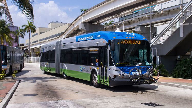
The Metrobus network provides bus service throughout Miami-Dade County 365 days a year. It consists of about 93 routes and 893 buses, which connect most points in the county and part of southern Broward County as well. Seven of these routes operate around the clock: Routes 3, 11, 27, 38, 77 (last bus from Downtown Miami 1:10am, first bus from Downtown Miami 4:10am), L (No 24-hour service to Hialeah, all trips terminate at Northside Station) and S. Routes 246 Night Owl & Route 500 Midnight Owl operate from 12am to 5am. Most other routes operate from 4:30am to 1:30am. All Metrobuses are wheelchair accessible, in compliance with the Americans with Disabilities Act of 1990 and equipped with Bicycle racks.
Contents
- History
- South Miami Dade Busway
- Former stations
- Routes that use the Busway
- Busway vs rail controversy
- Ridership
- References
Bus route 301 (Dade-Monroe Express) extends into Monroe County, reaching Marathon, where a transfer is available to a Key West Transit bus proceeding further into the Keys. With the appropriate bus transfers, one can travel all the way from Key West to Jupiter entirely on public-transit buses. Metrobus has many connections to Metrorail and Metromover, also operated by Miami-Dade Transit, mainly in the city of Miami.
History
Bus ridership has reached as high as 293,000 daily, but is generally around a quarter million. It reached a high during the real estate bubble of the 2000s, then declined during the bad economy amid service cuts during the Great Recession, before rising again in the 2010s. From 2015 into 2016, bus ridership fell sharply, down to a low of 195,000 daily in June 2016, amid the lowest gas prices in over a decade, despite a locally strong economy and steady population gain. This during a time when much effort was going into enhancements, such as an air-conditioned bus shelter, mobile ticketing, and new rolling stock, including electric buses. Part of the problem is that buses, unlike other transit alternatives, are not exempt from the increasing traffic present. Nationally, bus ridership fell while rail ridership increased slightly in 2015.
South Miami-Dade Busway
The South Miami-Dade Busway (originally the South Dade Busway) began operating on February 3, 1997 and was extended in April 2005. The final 6.5-mile (10.5 km) segment of the Busway extension to Florida City opened on Sunday, December 16, 2007. It is parallel to US1/ S Dixie Highway, and replaced an abandoned Florida East Coast Railroad line. It is an alternative to daily traffic congestion. The 13-mile (21 km) roadway was built by the Florida Department of Transportation just for Metrobus routes and emergency vehicles. Express buses on the exclusive lanes shuttle passengers to and from Dadeland South Station (see Metrorail) in under 40 minutes.
Both full-size and Articulated buses operate on the Busway and in adjacent neighborhoods, entering the exclusive lanes at major intersections. Local and limited-stop service is offered between Florida City and Dadeland South Metrorail Station. Park & Ride lots along the busway are located at SW 152d Street (Coral Reef Drive), SW 168th Street (Richmond Drive), SW 112th Avenue, SW 244th Street, and SW 296th Street. At Dadeland South Station, riders transfer to Metrorail. Riders headed downtown can transfer from Metrorail to Metromover, which consists of three shorter downtown loops, at Government Center Station.
The South Miami-Dade Busway features 28 stops, all of which have been converted to light-rail style stations. A multi-use path stretches the length of the Busway.
Former stations
Routes that use the Busway
Busway vs. rail controversy
The Busway has been the site of many accidents, as some car drivers driving south on US 1 (which runs parallel to the Busway for much of its length), and looking to turn west, do not stop at the red arrows that govern the right turn lane at an intersection that has a Busway crossing adjacent to it. They make a right turn and go right into the path of a bus that is entering the adjacent Busway intersection. Buses currently have to slow down to 15 mph (24 km/h) before crossing the intersection, and the police often patrol the intersections looking for red arrow runners. Surprisingly, even the intersections where the Busway runs as far as 2 blocks west of US 1 suffer the same problem, with car drivers either not seeing or flatly ignoring the red lights at SW 184th and 186th Streets. City planners and residents alike have commented that rather than dismantling the former Florida East Coast Railroad line for the busway, the Metrorail system could have been extended southward over the railway line.
Ridership
Ridership detail by average daily ridership on weekdays by month, with yearly average and highest ridership month in bold. Note the generally lower ridership during the summer months and December, month of the long Christmas and holiday season. Ridership has been falling since 2014 amid widespread rider complaints, an aging fleet, and sharply declining gas prices beginning in late 2014. Starting in 2016, this was also affecting Metrorail ridership. By 2016, 70% of the bus fleet was considered beyond its expected useful life, as the county was in the process of buying 30 electric buses with an option for 20 more. This is well under 10% of a fleet of nearly 1,000 buses. Other upgrades included a new mobile ticketing and contactless payment system, as well as upgrades to bus stops, including covering shelter-less bus stops and air conditioning at select locations. By mid 2016, average daily ridership was over 100,000 below a pre-recession peak in November 2007, and May, June, July, and August 2016 were the lowest ridership months in over a decade. Some of the ridership loss may be accounted for by overlap and growth of the free Miami Trolley and other pseudo-bus systems. Very poor numbers in October 2016 across the entire system were partially blamed on one day of closures for Hurricane Matthew, which passed close to South Florida. Annual ridership figures are rounded to the nearest 100. 2016 was the lowest ridership year since online records began in 1998.