
Time zone CET (UTC+1) Website Official website Dialling code 0533 | Elevation 1 m (3 ft) Dialing code 0533 Area 85 km² Local time Sunday 5:39 PM Postal code 44026 | |
 | ||
Weather 13°C, Wind E at 10 km/h, 84% Humidity | ||
Mesola is a comune (municipality) in the Province of Ferrara in the Italian region Emilia-Romagna, located about 80 kilometres (50 mi) northeast of Bologna and about 50 kilometres (31 mi) east of Ferrara. As of 31 December 2004, it had a population of 7,331 and an area of 84.2 square kilometres (32.5 sq mi).
Map of 44026 Mesola Province of Ferrara, Italy
Mesola borders the following municipalities: Ariano nel Polesine, Berra, Codigoro, Goro.
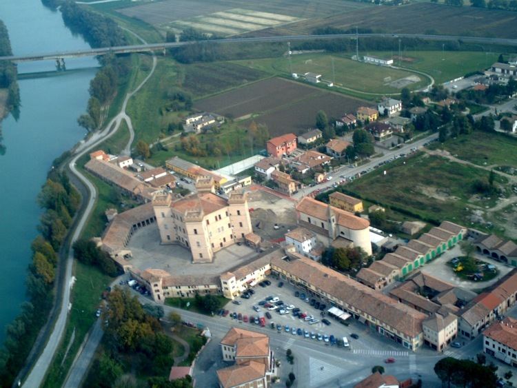
One of the landmarks in the town is the Castle of Mesola, built between 1578 and 1583, mainly used as a hunting lodge by the Este dynasty. It now houses the civic library and the Museum of the Wood and Deer of Mesola.
References
Mesola Wikipedia(Text) CC BY-SA