
Population 305 Civil parish Melbury Abbas Local time Saturday 9:17 AM | OS grid reference ST882200 Sovereign state United Kingdom Dialling code 01747 | |
 | ||
Weather 11°C, Wind W at 29 km/h, 91% Humidity | ||
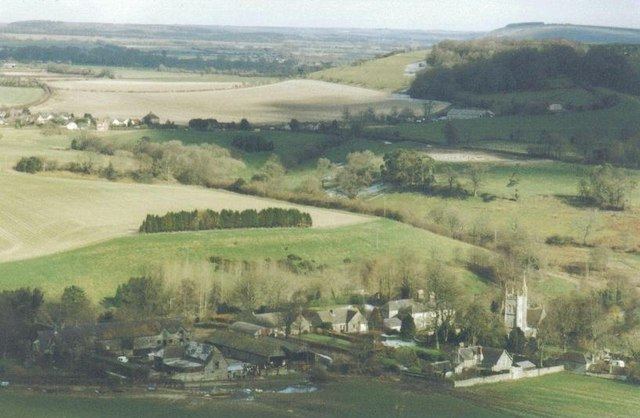
Melbury Abbas is a village and civil parish in north Dorset, England, situated between Shaftesbury and Blandford Forum on the edge of Cranborne Chase, close to Melbury Down. In the 2011 census the civil parish—which includes West Melbury and part of Cann Common—had 147 dwellings, 134 households and a population of 305.
Map of Melbury Abbas, Shaftesbury, UK
In 1086 Melbury Abbas was recorded in the Domesday Book as Meleberie. It was in Sixpenny Hundred, had 47 households, 12 ploughlands and 4 mills, and the lord and tenant-in-chief was Shaftesbury Abbey.
Melbury Abbas village is situated on an unclassified road that follows a hilltop route roughly parallel to the A350 primary route between Shaftesbury and Blandford. The A350 follows a lowland route through villages in the Blackmore Vale. Traffic uses the unclassified route as an alternative because it is straighter and passes through fewer villages. Melbury Abbas is the only bottleneck on this road, where it dips down into the valley and becomes narrower. Dorset County Council have considered bypass schemes, but none has got further than preliminary stages as the village is surrounded by conservation land.
There is a small airfield near the adjacent village of Compton Abbas. Prominent hills in the area include Melbury Hill (263 m) and Breeze Hill (262 m).