
Population 517 (2011 census) Postcode(s) 2780 Postal code 2780 | Established circa 1870 Local time Saturday 2:17 AM | |
 | ||
Weather 11°C, Wind SE at 16 km/h, 100% Humidity | ||
Medlow Bath (postcode: 2780) is an Australian small town located near the highest point of the Blue Mountains, between Katoomba and Blackheath. It has an approximate altitude of 1,050 metres (3,440 ft) and is located approximately 115 kilometres (71 mi) west-north-west of the Sydney central business district and 5 kilometres (3.1 mi) north-west of Katoomba. At the 2011 census, Medlow Bath had a population of 517 people.
Contents
Map of Medlow Bath NSW 2780, Australia
Description
Medlow Bath is set in a semi-rural area which includes fire-prone eucalypt forest, and has been subject to bushfire threats many times during its history.
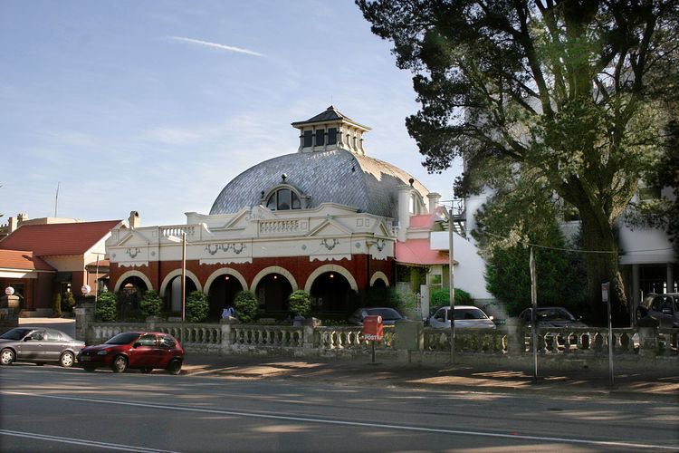
The Hydro Majestic Hotel was developed by Sydney businessman, Mark Foy in the early years of the twentieth century and was the main economic activity in the area, until bushfires nearly destroyed the hotel in the summer of 2003.
There is an elaborate network of walking tracks, which were developed in the bushland between the hotel and the escarpment of the Megalong Valley. The tracks offer scope for many fine bushwalks and views of the Megalong Valley, but in more recent years have deteriorated due to lack of maintenance. Other tracks in the area include Bruce's Walk, an old track that was upgraded by bushwalkers and other volunteers in the 1980s. Bruce's Walk is located a few kilometres east of Medlow Bath, on the fringes of the Blue Mountains National Park, a huge park that is now a World Heritage Site.
Australia's first Prime Minister, Edmund Barton, died at the Hydro Majestic Hotel in 1920.
Transport
Medlow Bath was connected to the Main Western railway line in 1880, when the station was called Brown's Siding. Medlow Bath railway station is now served by the Blue Mountains Line.
The Great Western Highway is the main road access route.
Katoomba Airfield is also located a few kilometres east of Medlow Bath.