
 | ||
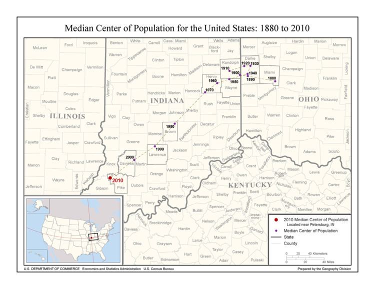
The median center of U.S. population is determined by the United States Census Bureau from the results of each census. The Bureau defines it to be:
the point though which a north-south line and an east-west line each divides the total population of the country in half.
As of the 2010 U.S. census, this places roughly 154.4 million Americans living on each side of a longitude line passing through a location in Pike County, Indiana, and the same number living on each side of a latitude line through the same point.
During the 20th century the median center of U.S. population moved roughly 180 mi (290 km) southwest, from a location in Randolph County, Indiana to a location in Daviess County, Indiana. The majority of this southwest shift happened in the second half of the century, as the center shifted within a narrow circular band between 1900 and 1950 – all within roughly 25 mi (40 km) of the 1900 starting point in Randolph County.